On The Emerald Edge

Exploring the shores of Lake Macquarie and beyond

The Spit, Mosman to Kirribilli

September 27, 2019

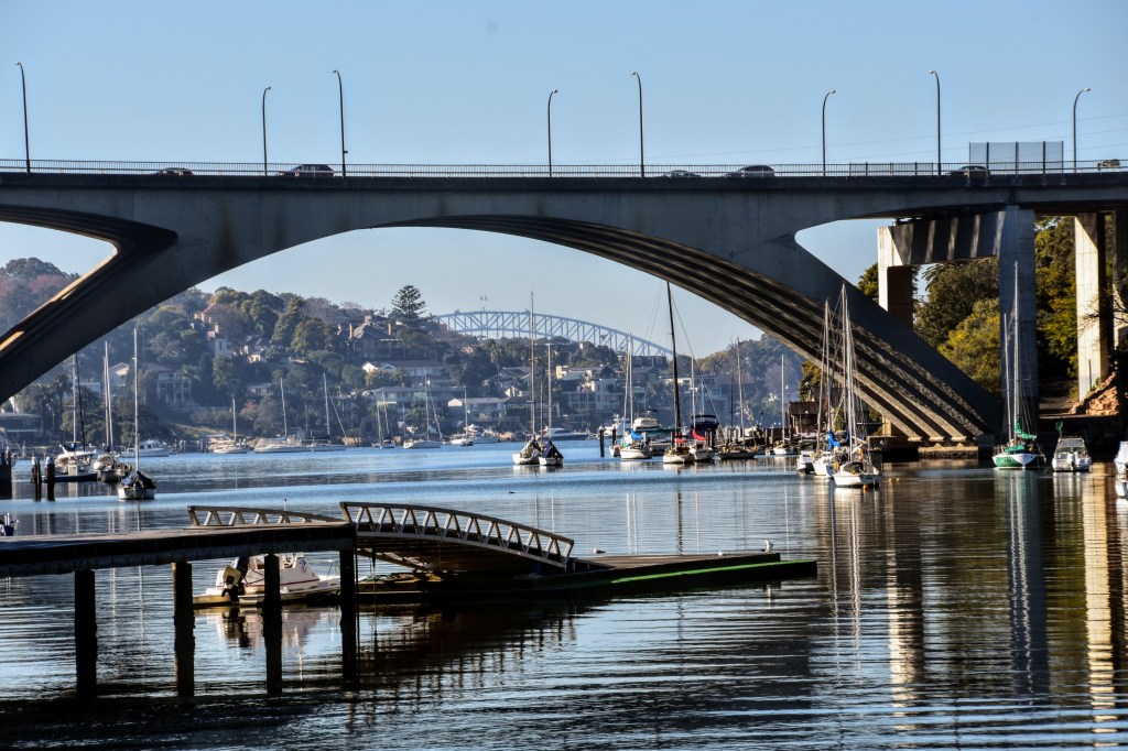
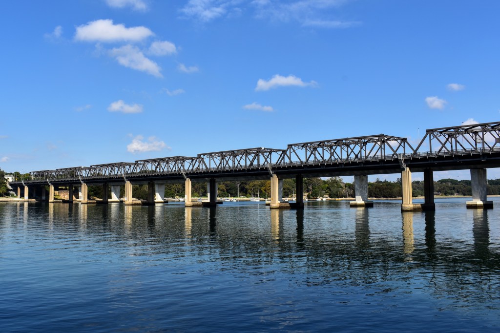
The Spit Bridge is an unofficial barrier between the northern suburbs and the northern beaches, a subtle division only appreciated by Sydneysiders. It’s not a border between the haves and the have-nots, more a separation between the haves with harbour access and the haves who prefer the ocean swells.

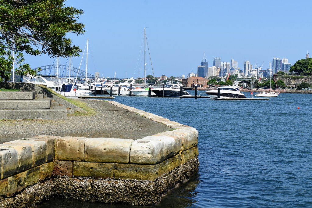
But in the usual egalitarian Sydney way, The Spit is a gateway to Sydney Harbour open to anyone. Basically one large marina, it offers access to Middle Harbour to the east and the north-west, and is the starting point for the famous Spit to Manly walk.

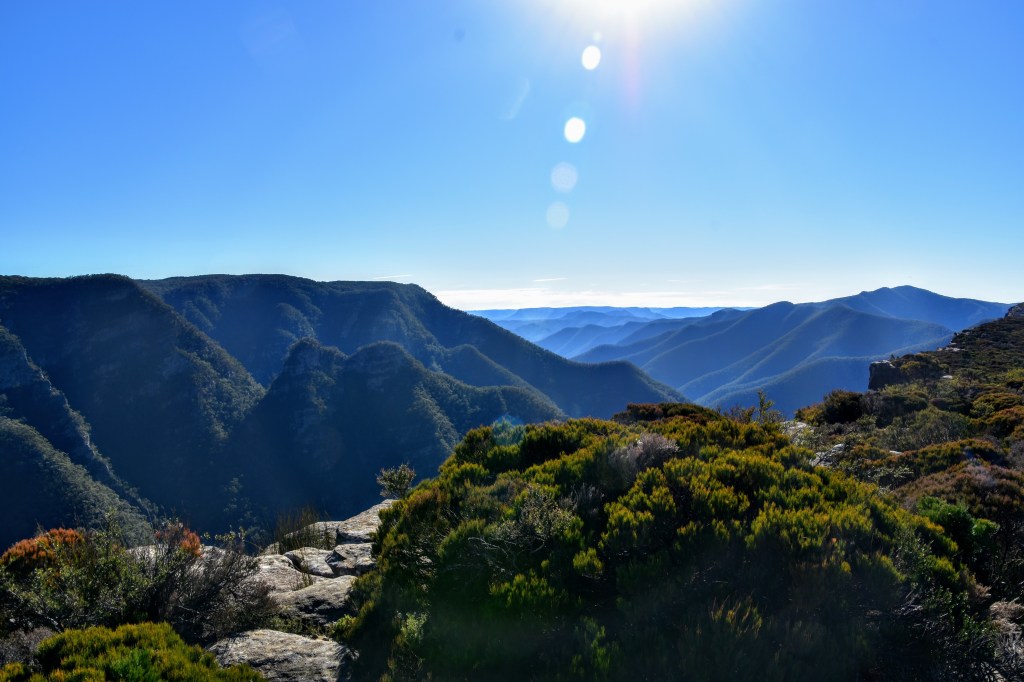
It’s also a great starting point for a walk in the opposite direction. Head up Parriwi Rd and the traffic noise from Spit Rd drops away quickly, while panoramas across the harbour to the east start to unfold.

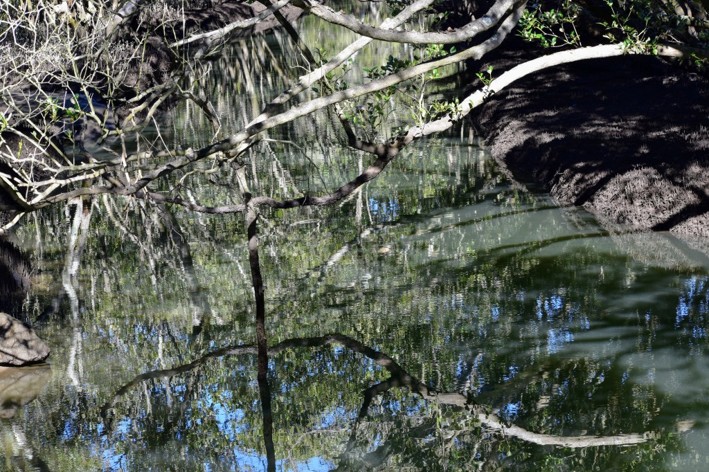
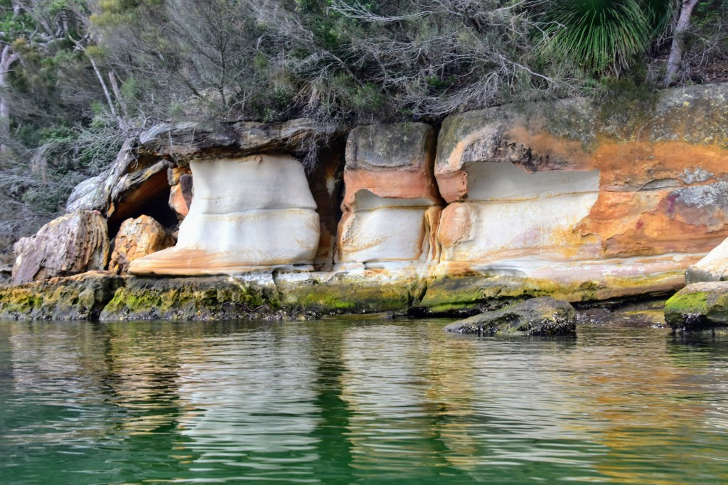
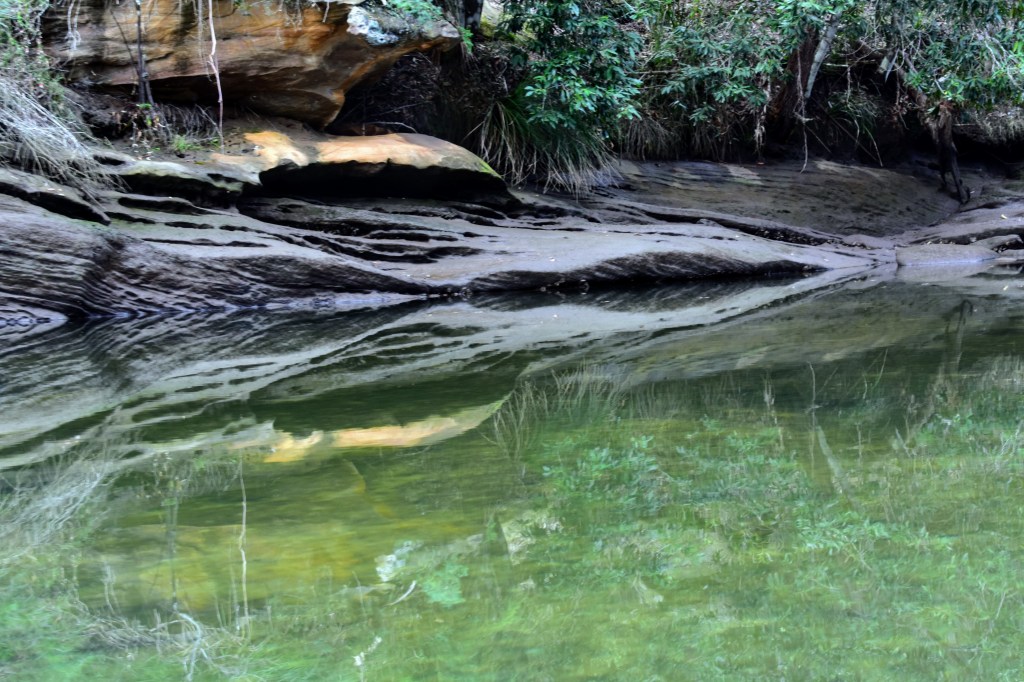
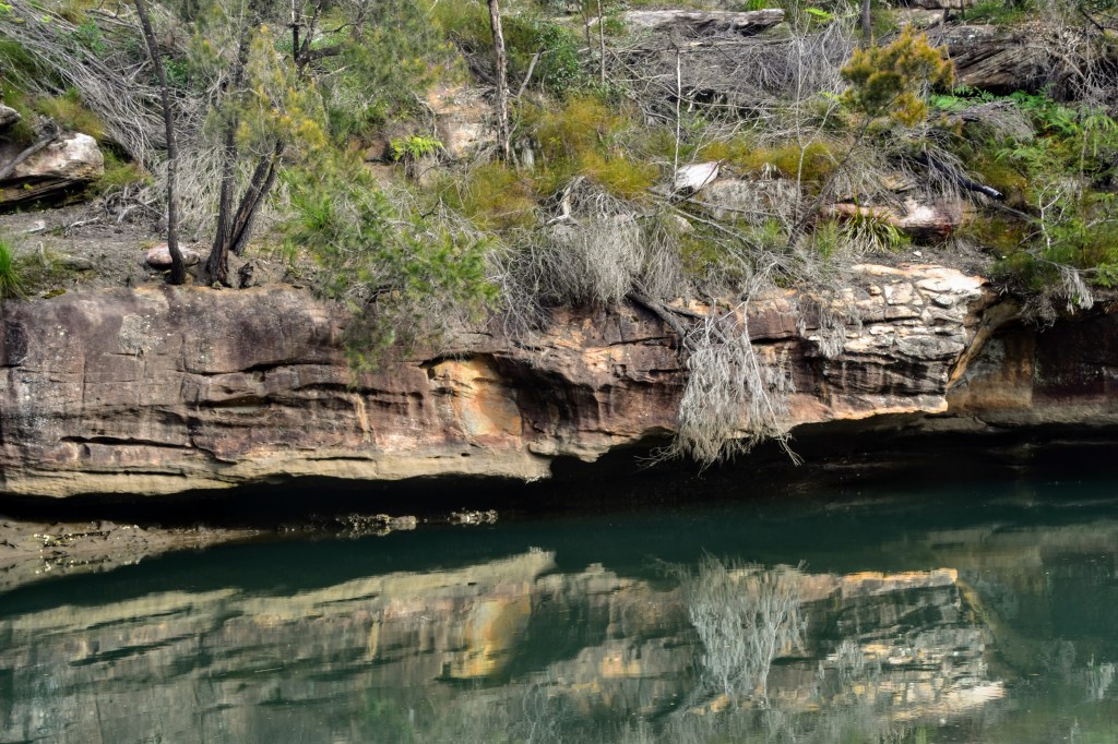
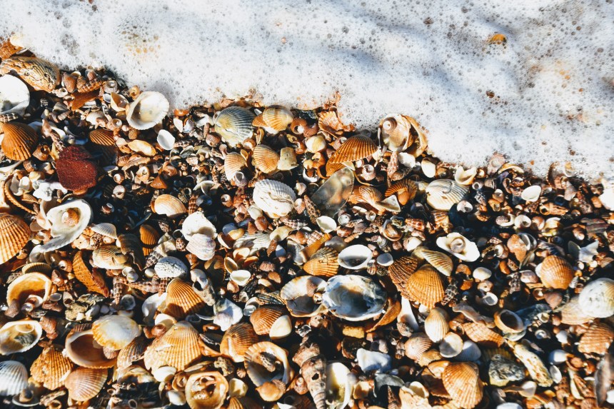
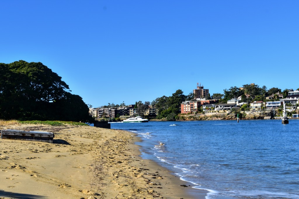
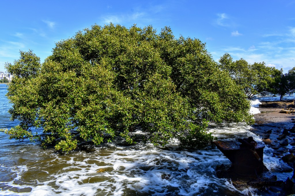
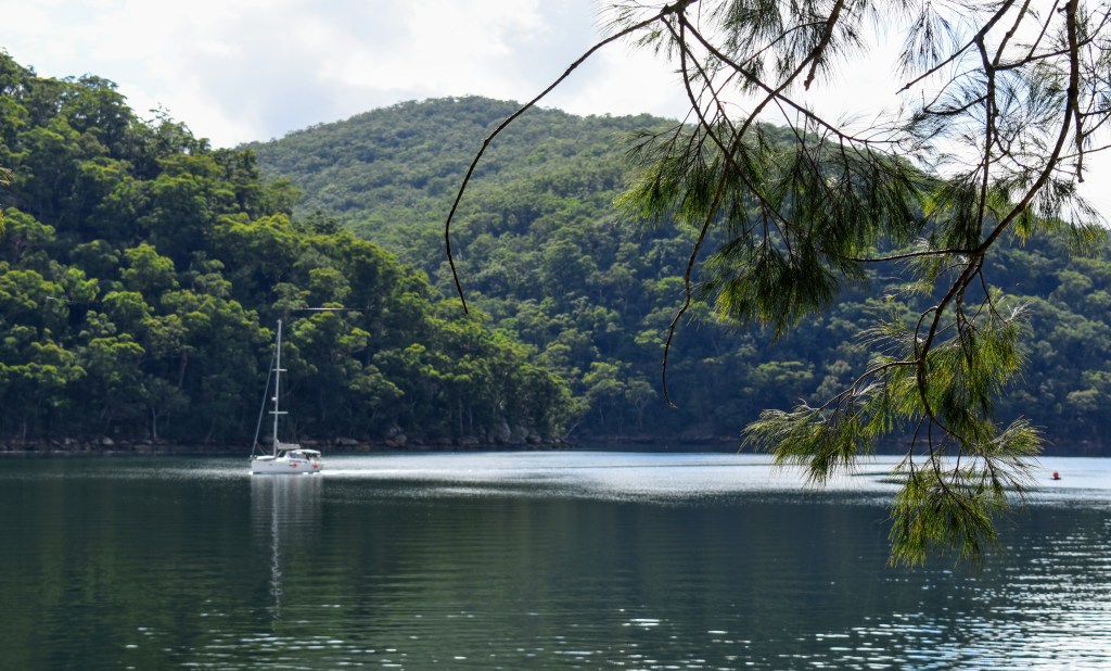
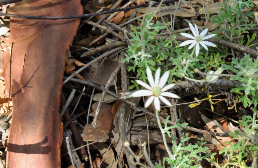
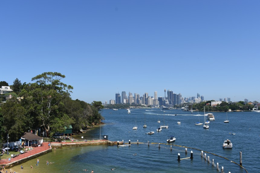
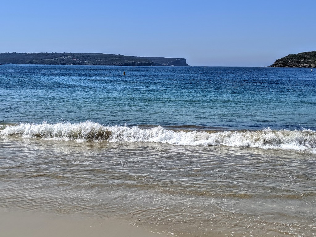
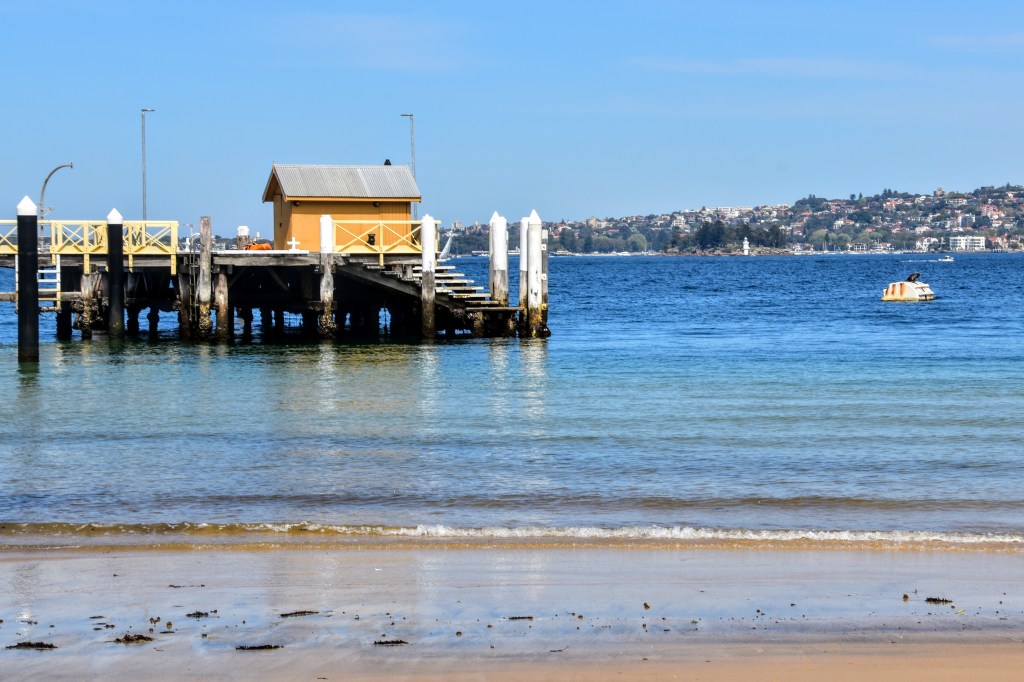
It’s not long before I come across Parriwi Lighthouse, from which a steep track descends to the shoreline, snaking its way between some of the city’s most expensive real estate. The tide is low, so I’m able to make my way away around the rocks to Chinamans Beach, surely one of Sydney’s unsung secrets. There are maybe a dozen people on the beach, most of them mothers with young children.

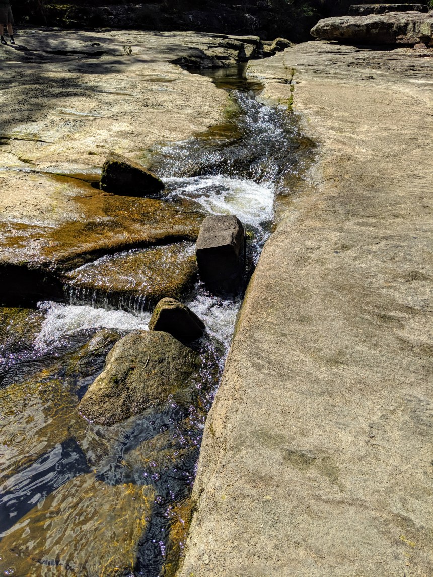
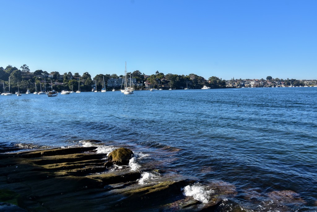
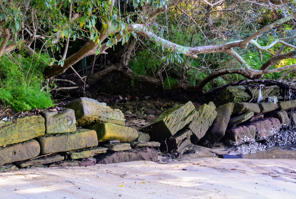
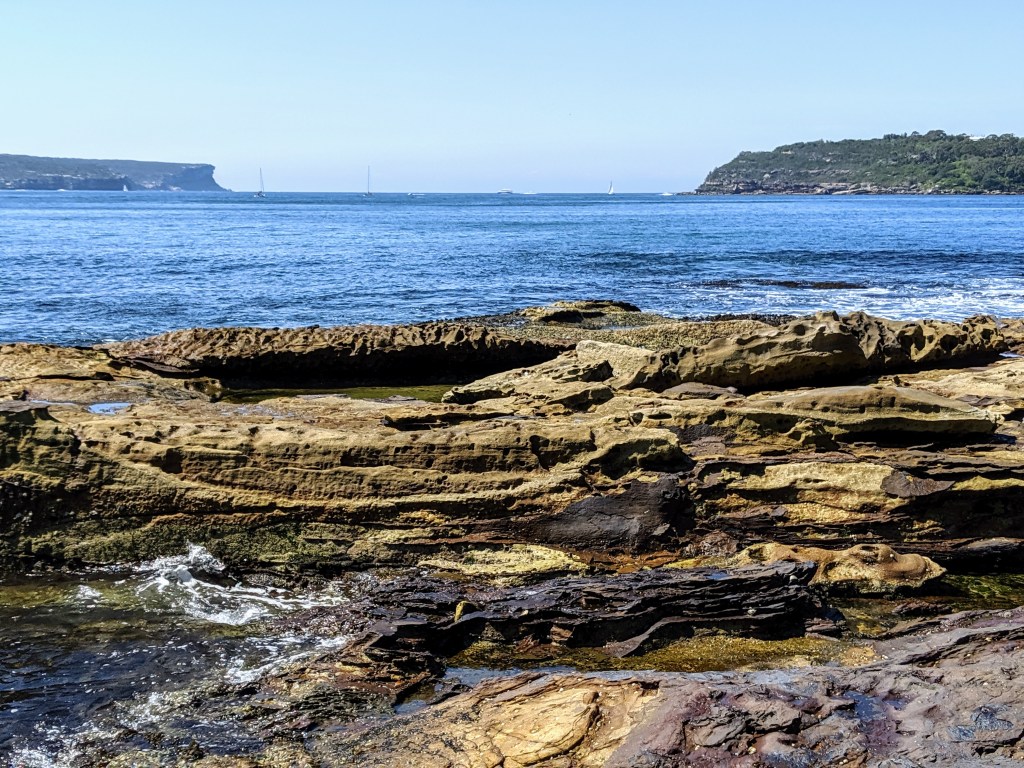
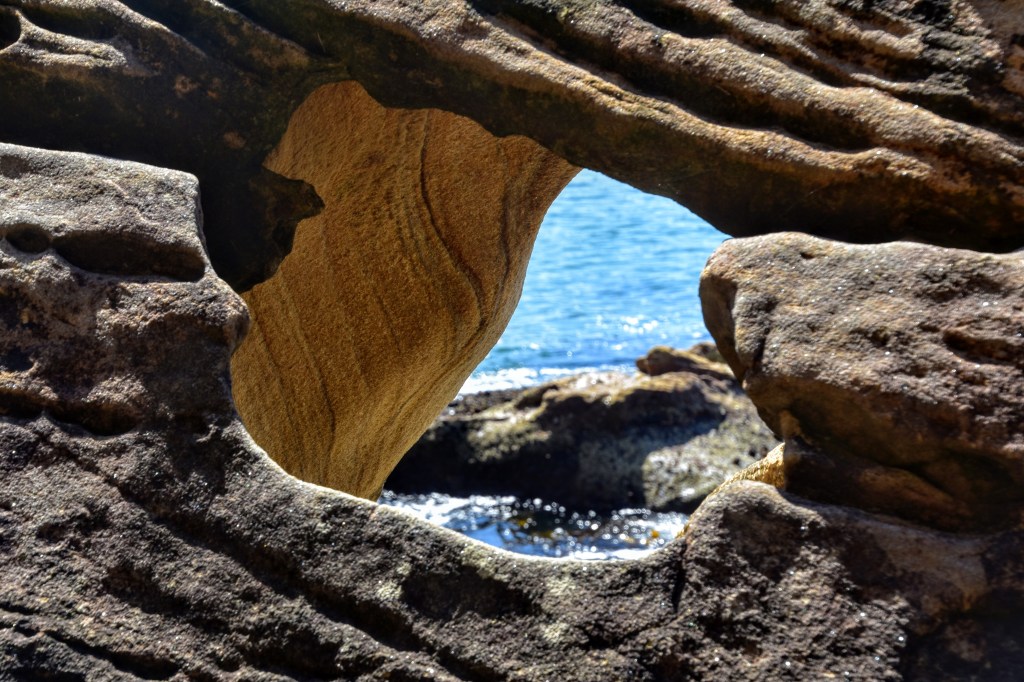
After checking the conditions with a local, I venture around Wyargine Point towards Balmoral Beach. The tide is fairly low, so much of the rock platform is exposed. There is a track of sorts, in parts, but at times I find myself traversing a narrow ledge which borders the sandstone property walls.

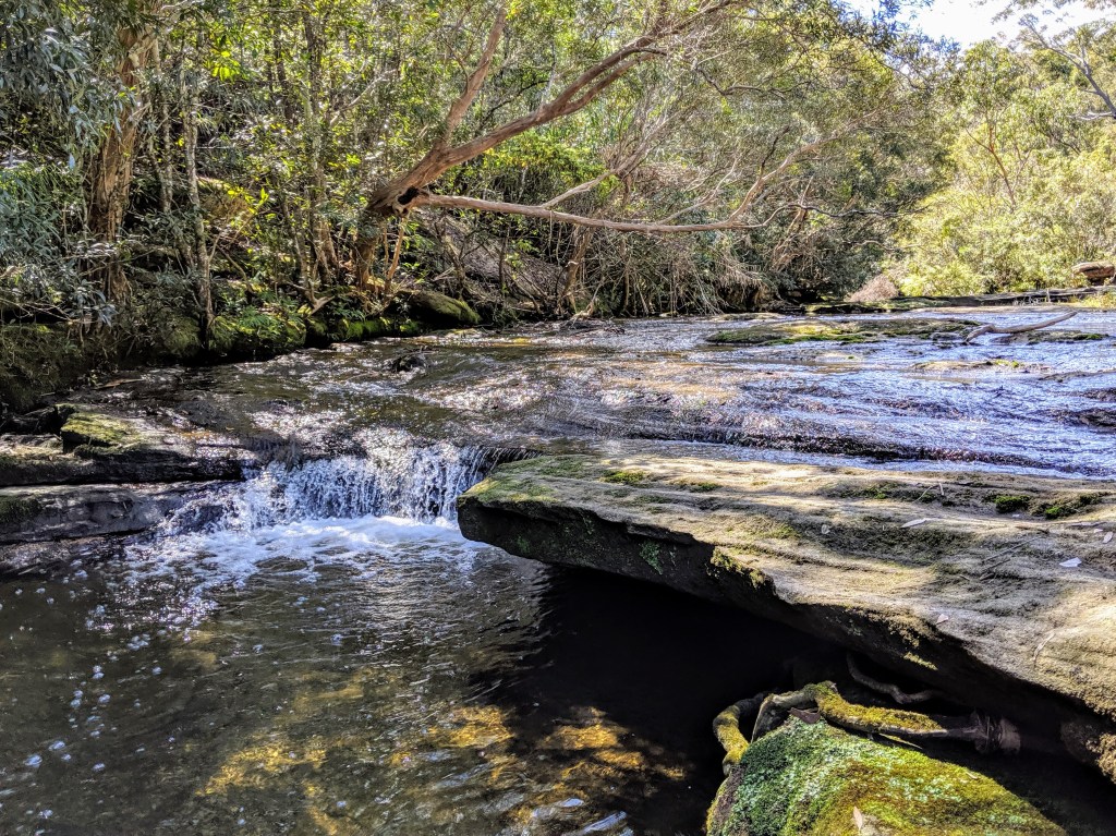
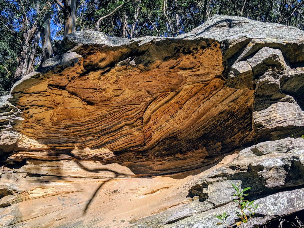
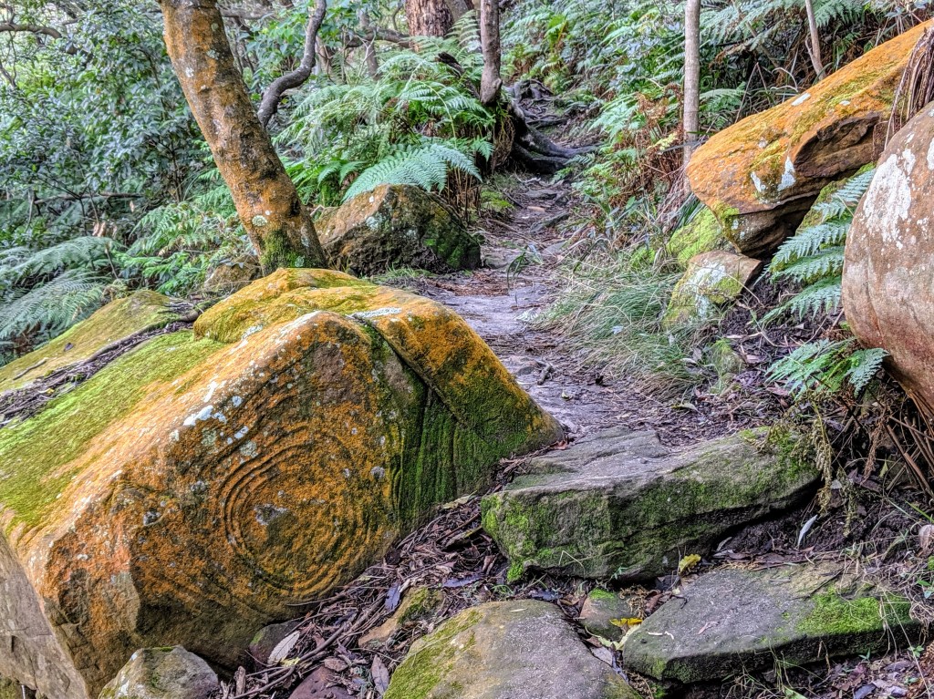
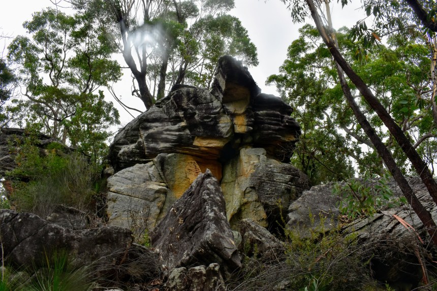
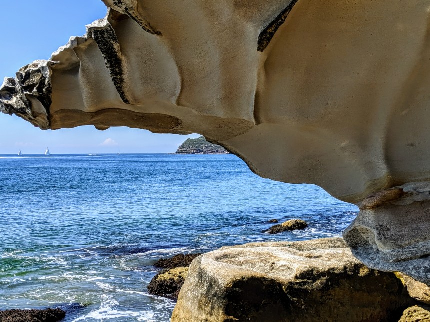
At other times, I’m forced to recall some long-forgotten bouldering moves as I pull myself over wind-sculpted sandstone outcrops, negotiate some narrow passages and waddle under overhangs. Boulders of various sizes scatter the shore in many places, so rock-hopping is the order of the day. At dead low tide it would probably be easier, but – as much as I loved it – I’d caution against this route unless you have reasonable agility.

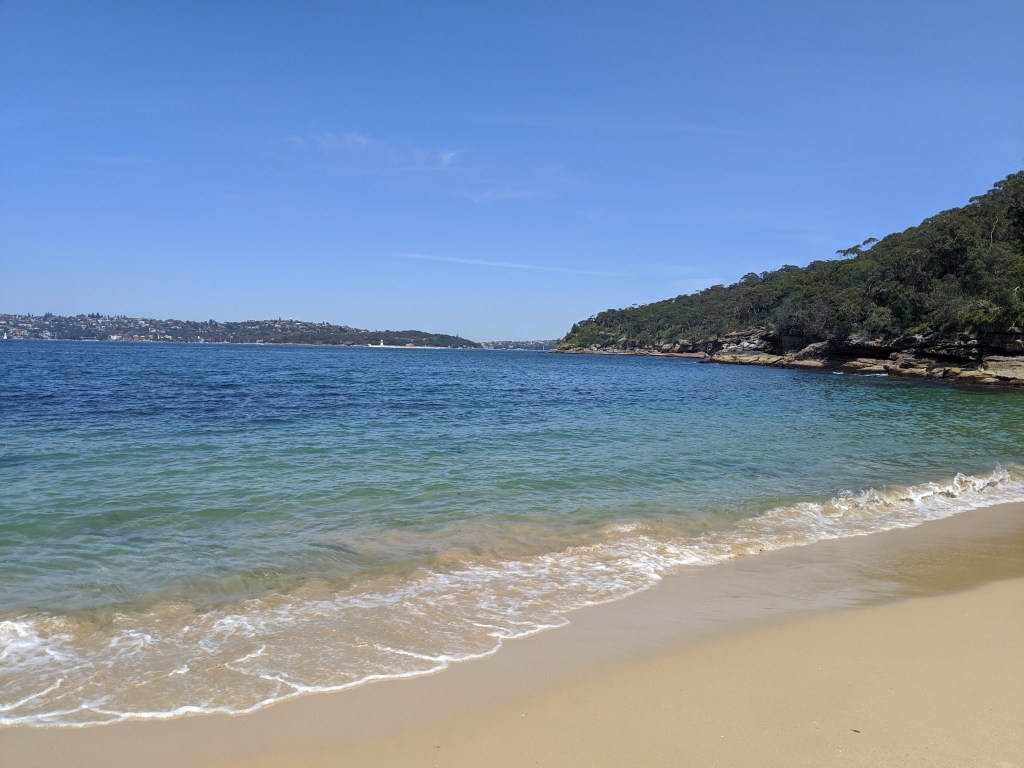
The “quiet end” of Balmoral Beach is well – quiet – frequented mostly by older locals and mothers with toddlers playing in the shallow waves. Rocky Point Island provides an awesome view through the heads, but once past there it gets pretty busy, with adults, kids and teenagers covering the sands and grass under the fig trees.

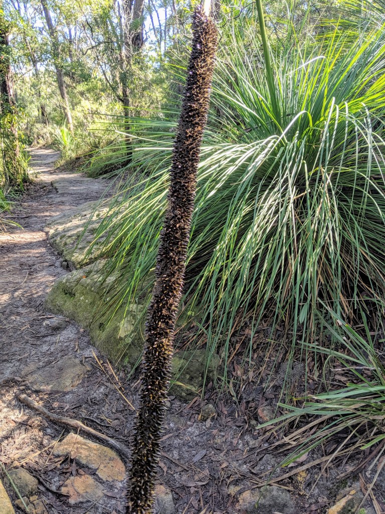
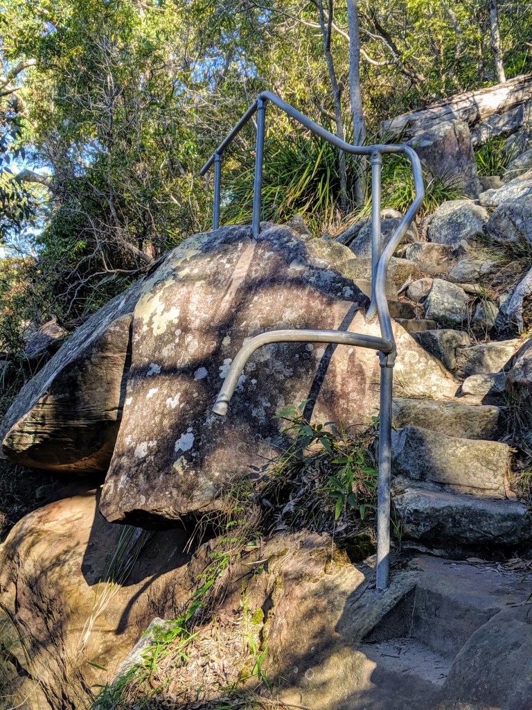
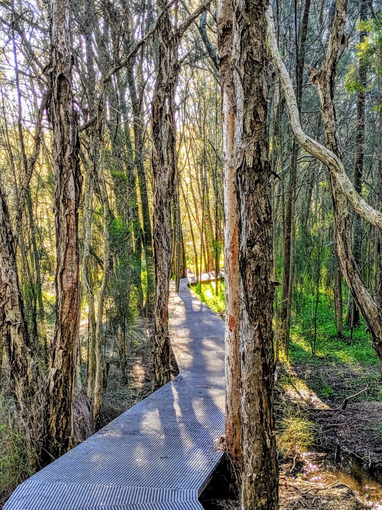
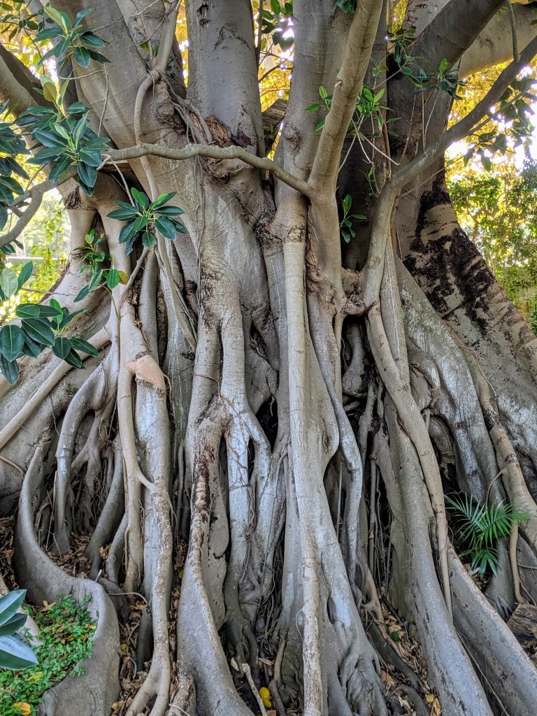
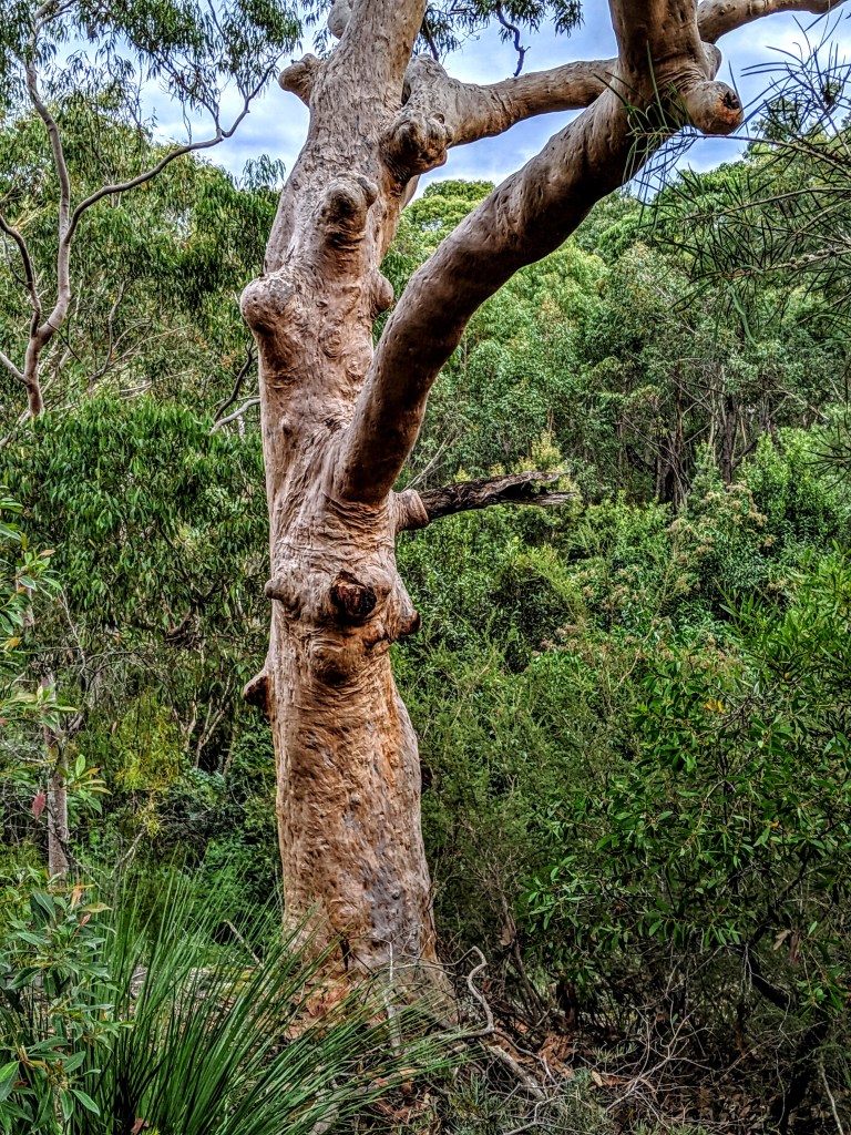
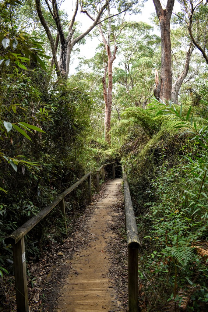
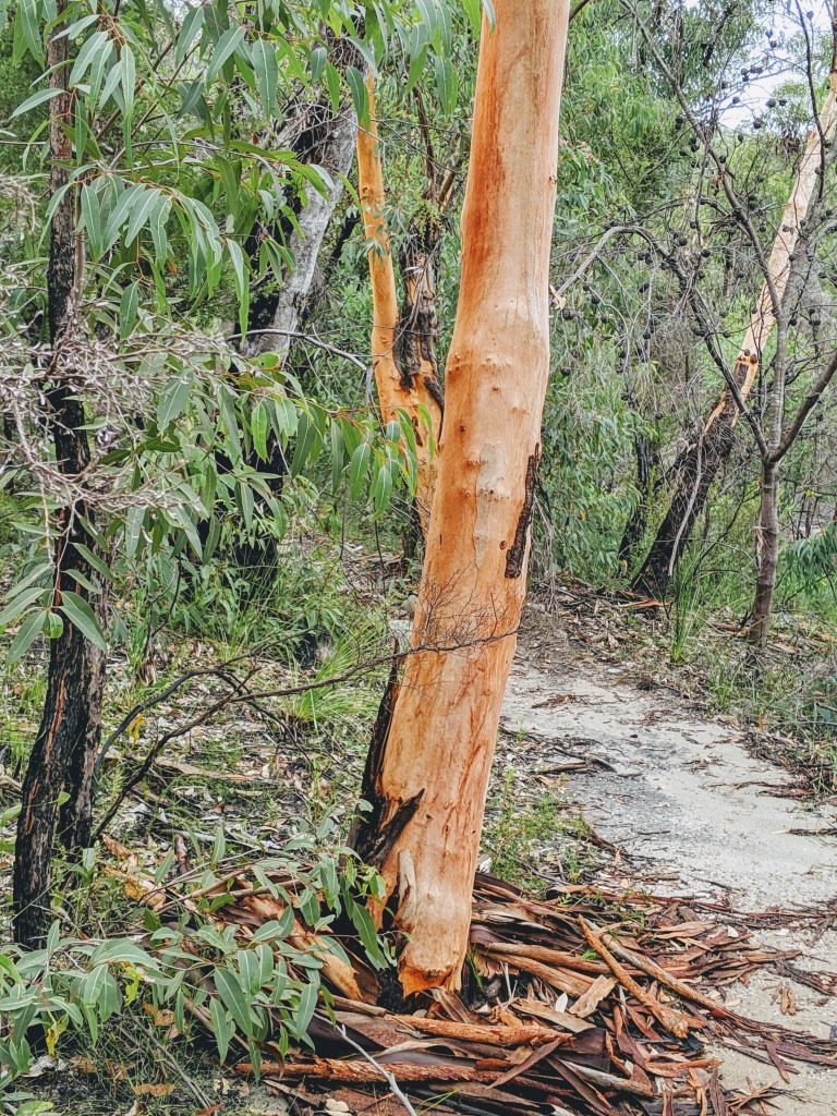
Heading across Balmoral Park (home to some very good times in my teenage years best left undescribed here), I pick up the track which leads up to Middle Head. There are steps – lots of them – but the ascent up the timber and steel walkway is gradual, surrounded on both sides by a forest the local council is trying to protect from die-back.

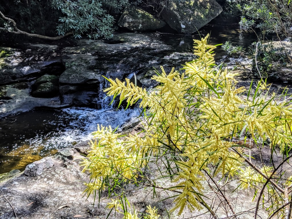
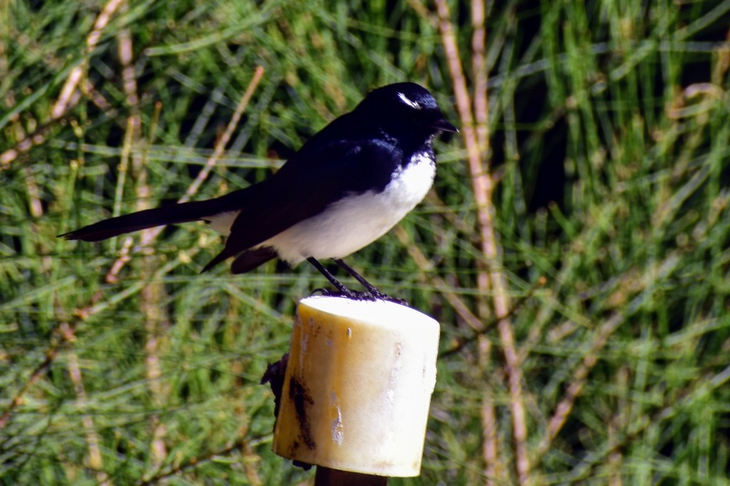
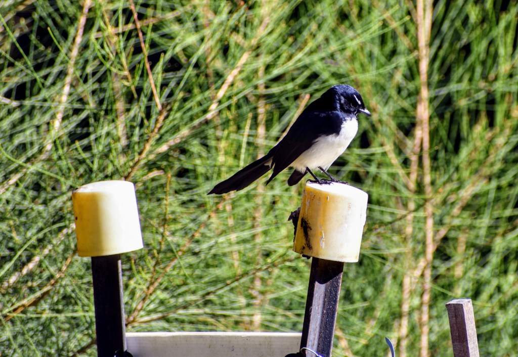
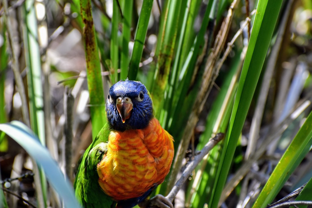
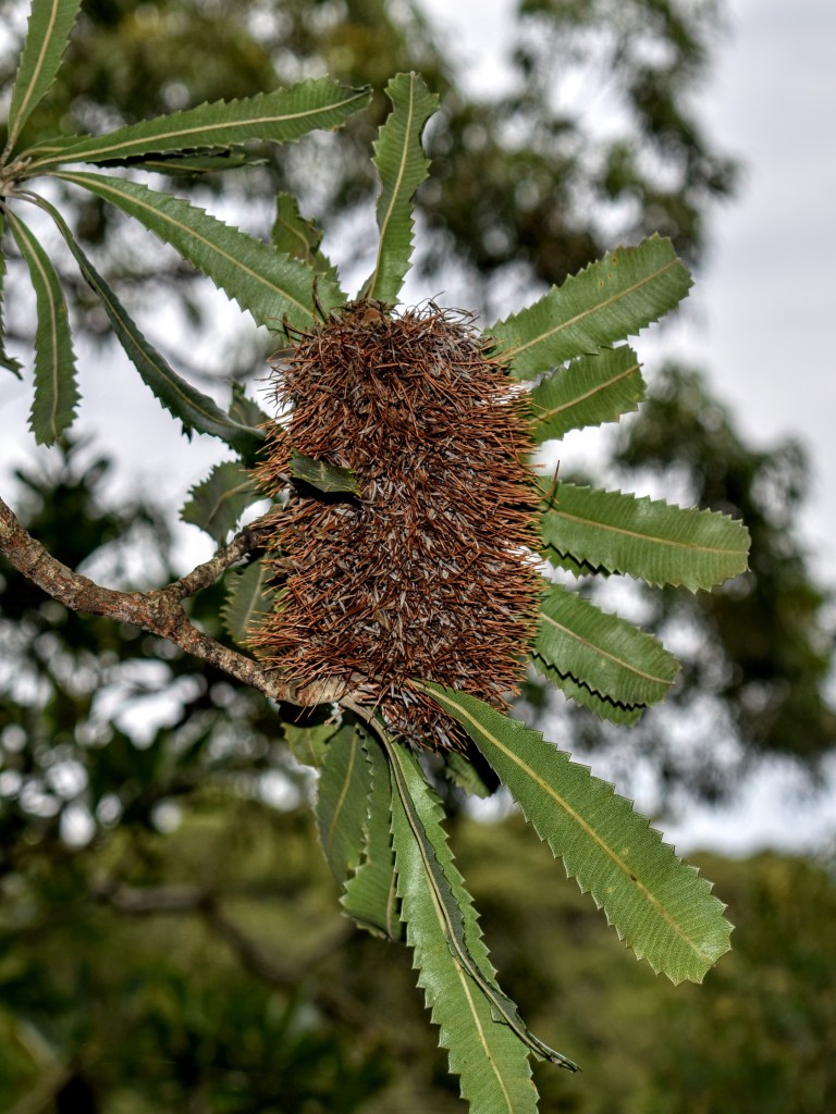
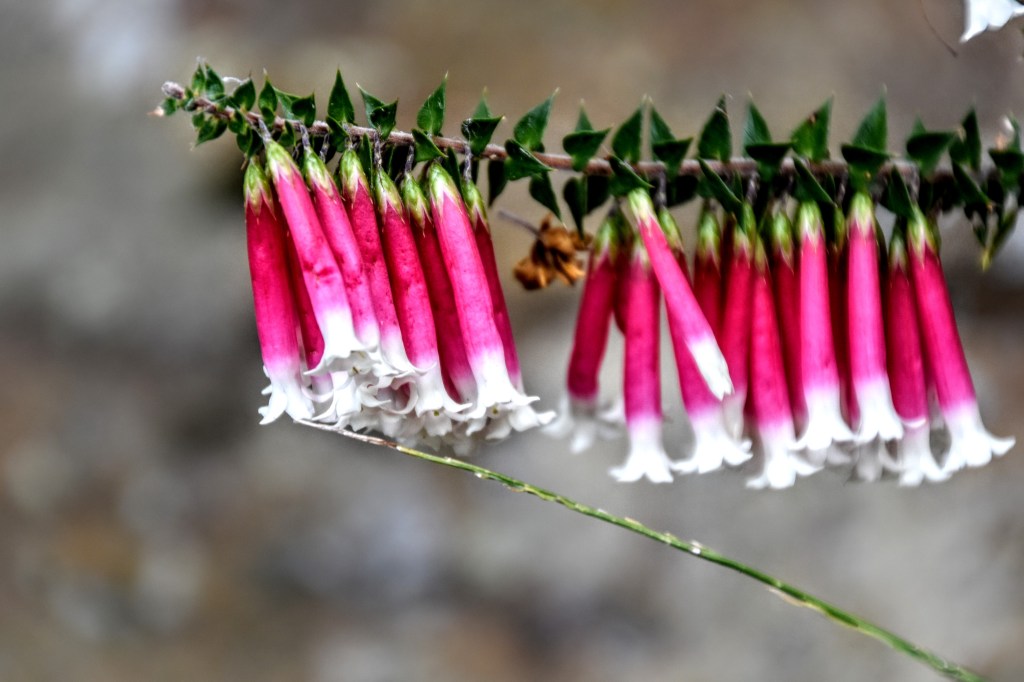
There is a newish-looking walking trail alongside Middle Head Rd. The acacias and hakeas are in flower, and the whip-birds and kookaburras are in song, which makes for pleasant, easy progress. Eventually, the track meets the road again, which heads north-east towards Middle Head.

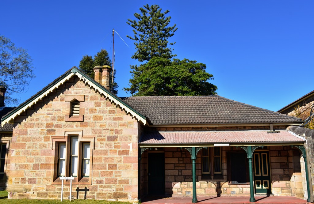
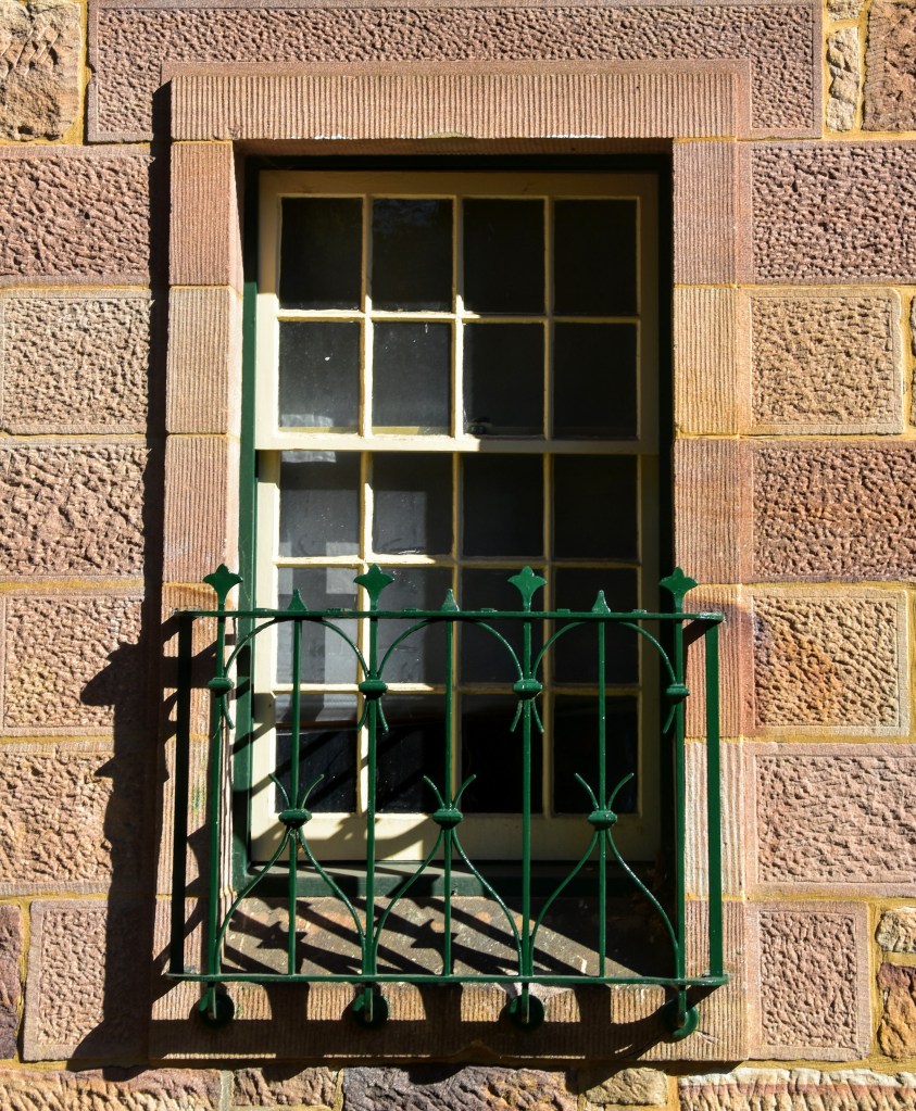
Middle Head has been an important military position from the early days of the colony in the late 1770s (check) right through to post World War II. The headland is riddled with old gun emplacements, tunnels, arsenals and lookouts, and remains home to many historical buildings.

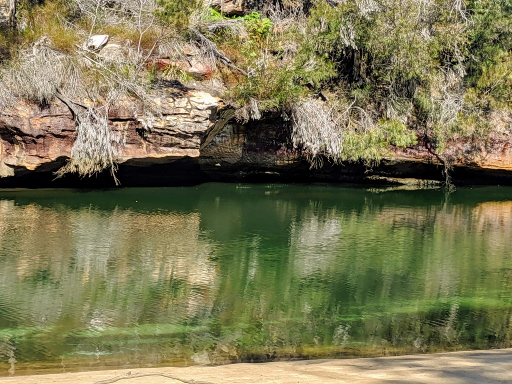
It’s worth a few hours exploring in itself, which I don’t have time for today, so I do a u-turn into Chowder Bay Rd then head out to the Georges Head 1801 battery, which commands brilliant views across to the eastern suburbs. I retrace my steps to the road, which I follow until I see the track marker for Obelisk Beach.

Nudity is optional on Obelisk Beach – be warned – but it’s not compulsory. It’s a fairly short but steep track down to the beach, so-named because it’s the location of one of the obelisk markers which guide ships into Sydney Harbour. The displays of pale male flesh aside, it’s worth the detour to catch some outstanding views down the harbour, and it would be a great spot for a dip if you have time.

Unfortunately, I have to follow the road from here, but there’s little traffic apart from the occasional cyclist. A track heads off via the Beehive Casemates (more military installations) then rejoins the road before heading into Chowder Bay.

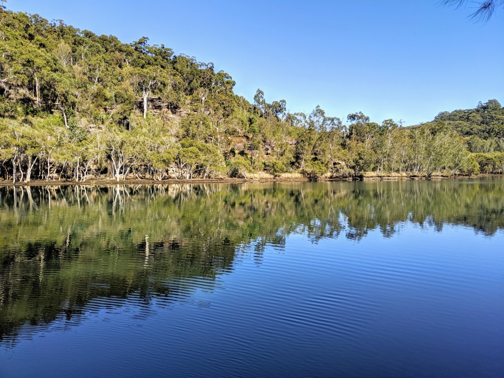
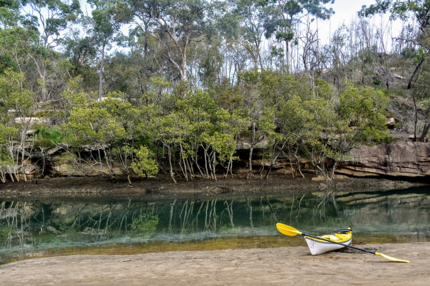
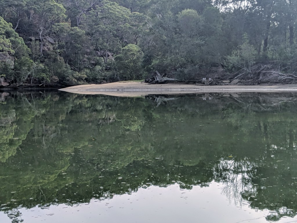
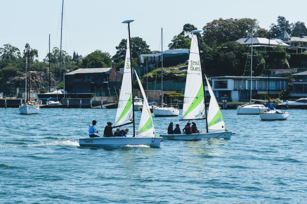
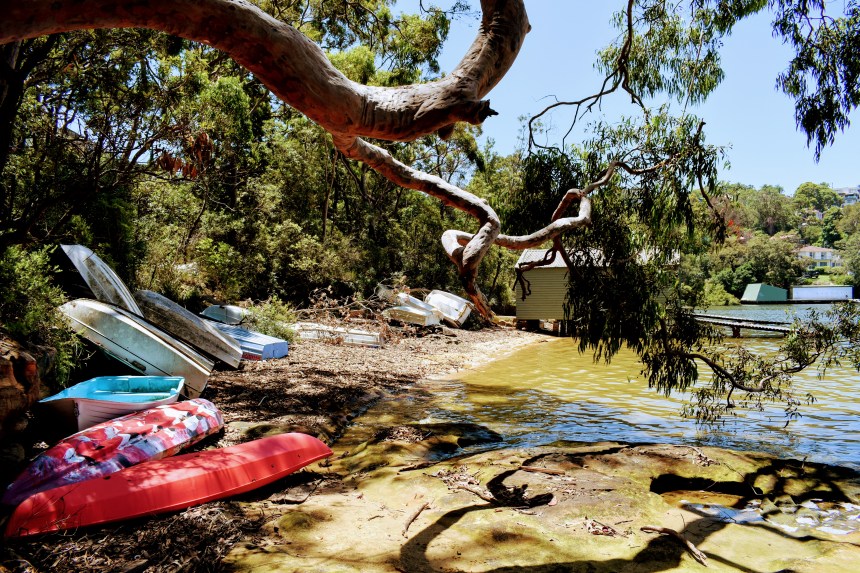
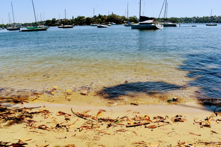
Here lies another of the beautiful well-known secrets of Sydney Harbour – Clifton Gardens. This is a picturesque mecca for picnickers, swimmers, snorkelers, small boat enthusiasts and many others, and I wonder why I haven’t visited for a couple of decades. It’s quiet today, but I expect you’d need to stake your claim early on a summer weekend.

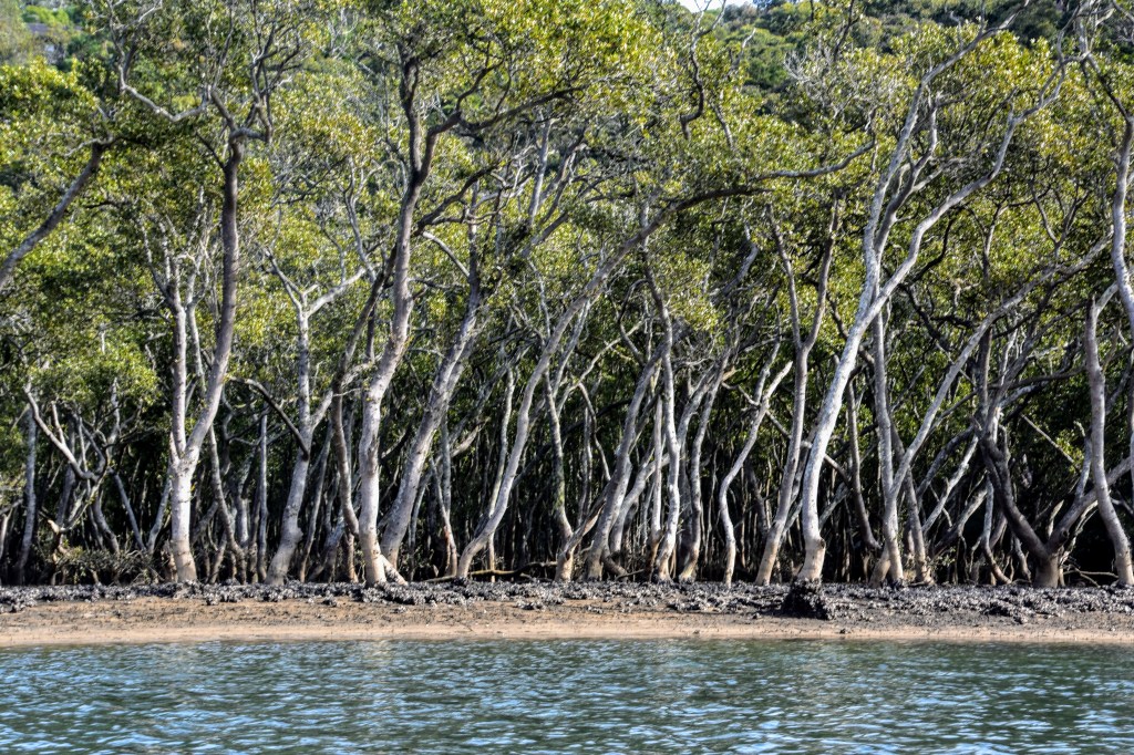
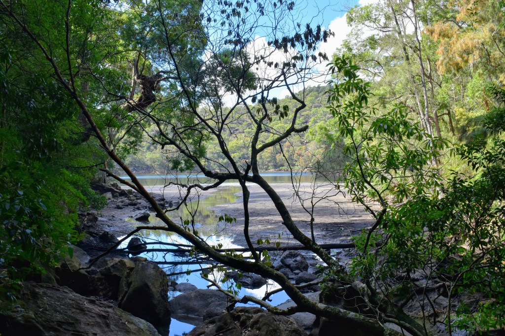
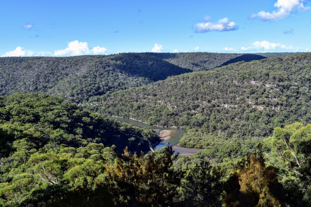
After a quick lunch, the track leads up to Gooragal Headland. This is a deep bushland, so you forget you’re only hundreds of metres from suburbia. The track heads around to Taylor’s Bay, skirting the ridgeline above the shore. For a while, we intersect with housing again, then head back into the bush towards Bradley’s Head.

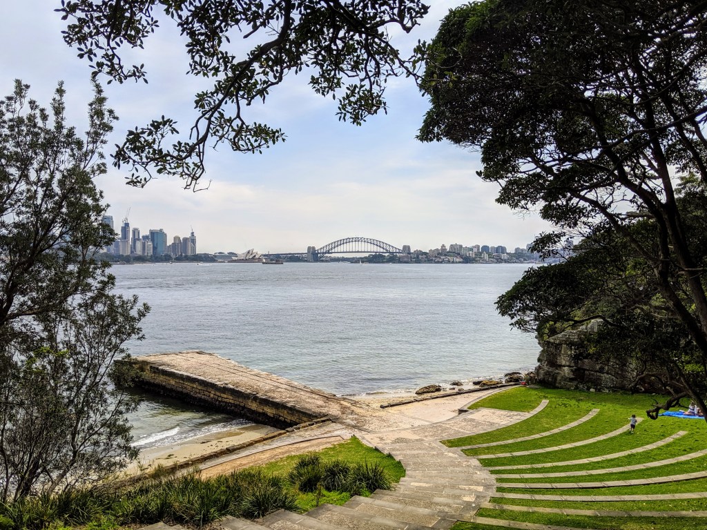
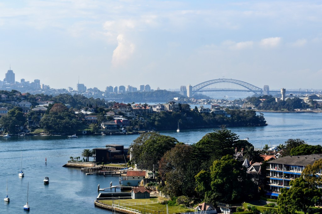
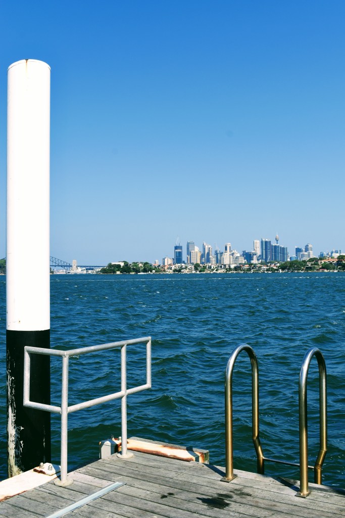
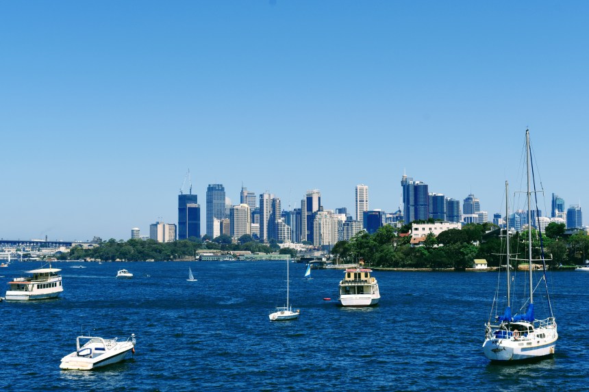
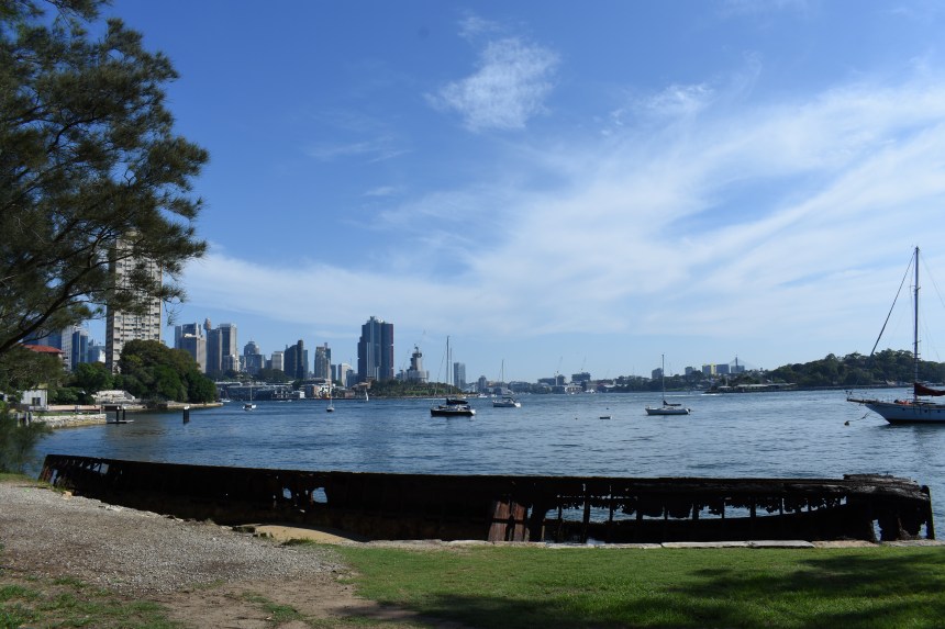
From the water, Bradley’s Head is extremely visible, the location of not only a lighthouse but also the foremast of the HMAS Sydney which acts as a memorial for the many Australian ships and sailors lost at sea during war. It is both a sombre and enlightening spot, with gun-barrel views towards the Sydney Opera House and the Harbour Bridge.

From here, the track follows the shoreline past Athol Bay to Taronga Zoo and its ferry wharf, towards Sirius Cove, which has its own place in Sydney’s history. Named after one of the ships in the First Fleet, Sirius Cove was the site of Curlew Camp, a home for some great Australian artists in the late 1880s.

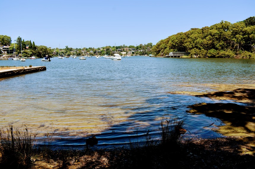
From Sirius Cove, I follow the local streets over the headland to Mosman Bay, another well-known but less-often-visited sanctuary. From here, there is a paved path around Cremorne Point, which is truly eye-opening.

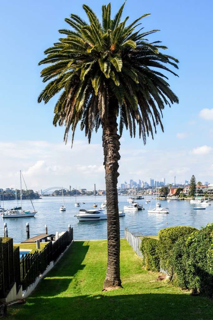
Cremorne is well-populated, and it’s not cheap, but it is home to some classical federation and post-WWI architecture which blends into the foreshore bushland. I come across an “accidental” garden created by local residents Lex and Ruby Graham over many years – it’s a little precarious, but demands more time for inspection than I have today.

Cremorne Reserve at Robertsons Point offers 180 degree views from the Heads to the city, and is worth spending some time at. The locals watch the sunset there, no doubt the sunrise is equally impressive.

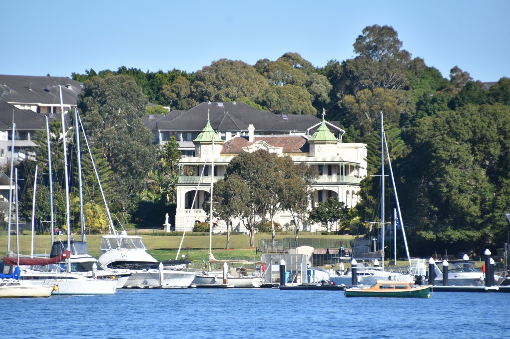
Heading back into the next bay, there is a saltwater pool and lots of ugly apartment buildings with extraordinary views – such a Sydney paradox. But it is pretty and calming as I walk around the shoreline, then use the streets to cross Kurraba Point, passing by Nutcote, the home of May Gibbs. Nutcote is only open at set times, so I plan to go back to learn more about how Snugglepot and Cuddlepie came to life.

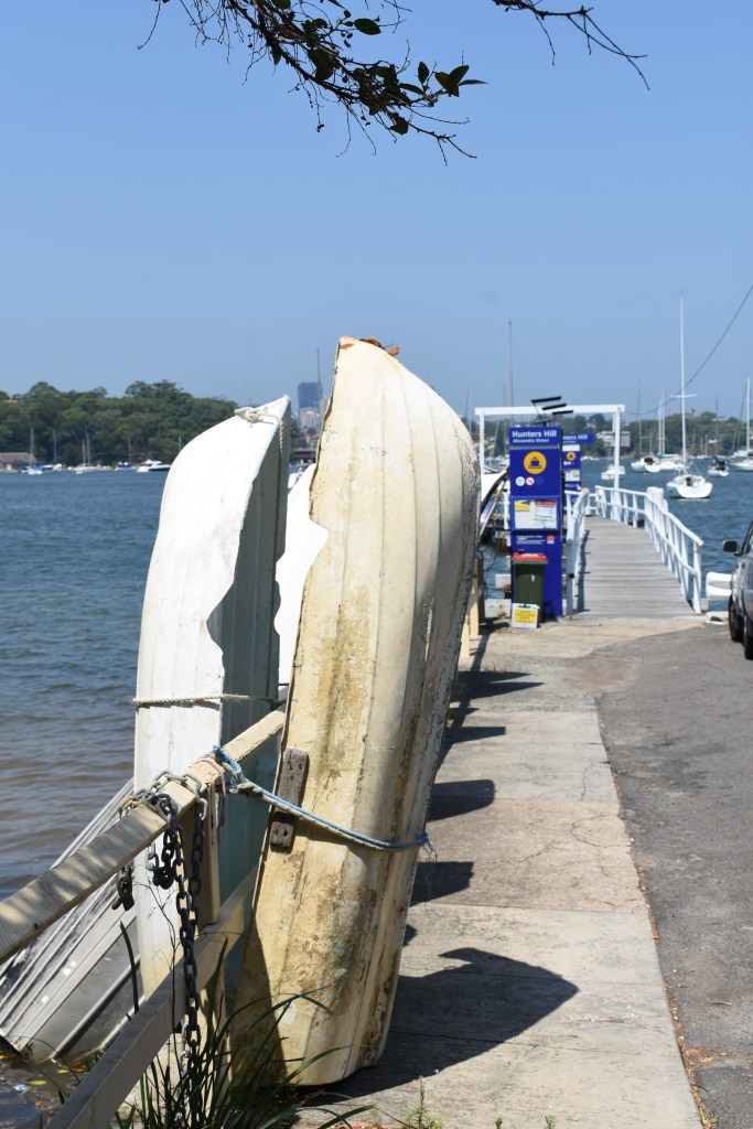
We’re right back in suburbia now, but there are some interesting sidelights. The path from the streets drops down into Anderson Park on the “real” Neutral Bay – where many of the Sydney Harbour cruise boats moor, and once the home of submarine base HMAS Platypus.

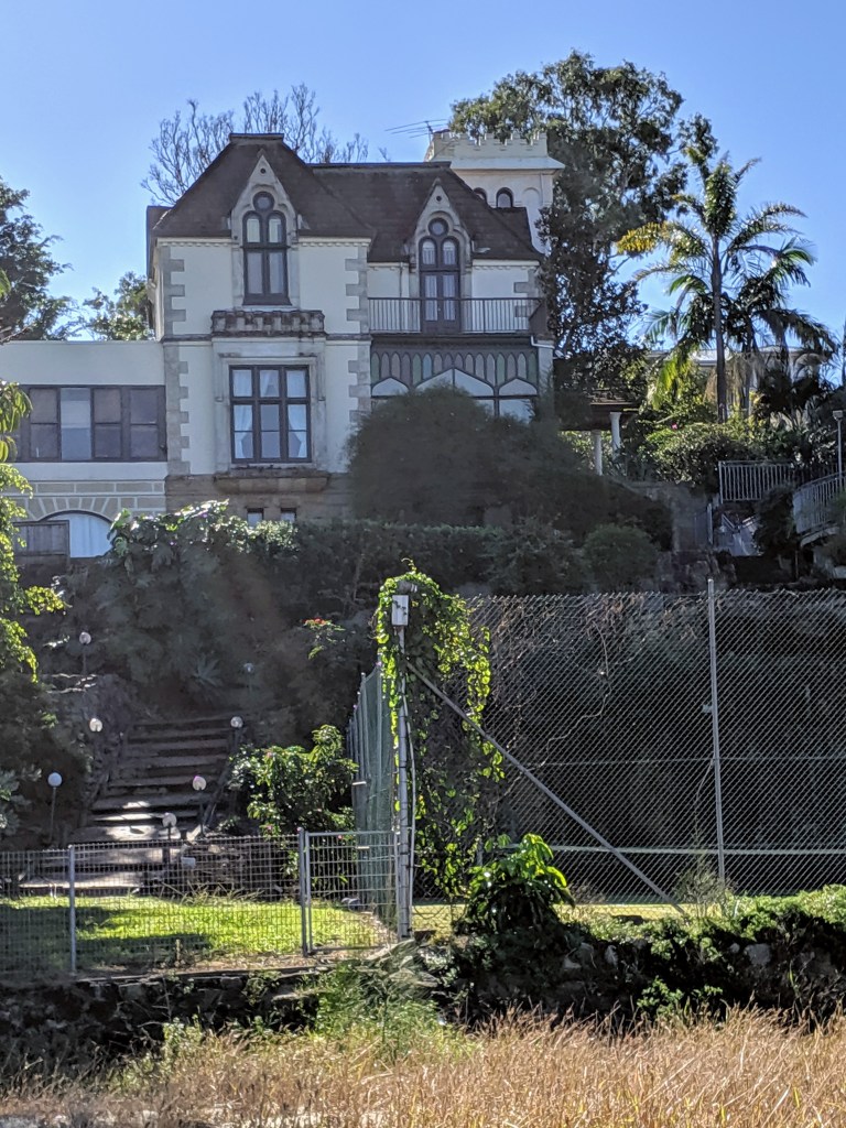
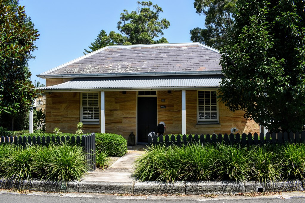
From here, the sandstone wall-lined streets snake upwards into Kirribilli. Like so many parts of this walk, Kirribilli is characterised by small heritage houses, most of which have been upgraded and moved beyond the expectations of the average mortgage-holder. But they look great.

At the top of the hill is the Kirribilli Hotel, where they serve a wide selection of beers on tap. Just what you need after +20kms walking on the Emerald Edge.

Garigal National Park – The Cascades

September 11, 2019

Garigal National Park is one of the smallest in the Sydney area, nestled between well-known suburbs either side of Middle Harbour Creek and bounded by a couple of major roads. And it’s not that well known, apart from the Davidson Park picnic area, which teems with recreational visitors every weekend.

It’s also not that easy to get into Davidson Park, but once you do, it’s well worth it. Access is via Warringah Rd, southbound, just before the Roseville Bridge. Having navigated that, on a weekday morning, there’s no one around, so we head across the grasslands and soon leave the hum of the traffic behind.

The track follows Middle Harbour Creek, which is incredibly still and reflects the blue of the sky as well as the mangroves, casuarinas, melaleucas and eucalypts which fringe the shoreline and the valley slopes. It’s easy, flat walking, and we’re constantly greeted with beautiful vistas across the creek as we round the bends.

There are plenty of acacias in flower, but only a few other wildflowers. Regardless, there is a rich texture to the bush, as it flows from rainforest to dry sclerophyll. There is a great diversity of ferns, particularly, but plenty of other shrubs.

An incoming creek sends the track to the east until we can cross further up and return to the main waterway. As we head upstream, we find ourselves passing by sandy beaches and sandstone overhangs reflected in the still waters.

My walking app is a little fuzzy on where the track actually goes, but there are a few national park signs which keep us heading in the right direction. And it’s pretty well-defined, so a bit hard to get lost. We punch on past Stepping Stone Crossing (our route home) and head towards the Cascades.

The Cascades were a complete mystery to me before setting out, but my walking mate was aware of them as a local secret. When Sydney copped a deluge in late August, they were apparently spectacular, but even a couple of weeks later they are incredibly beautiful.

The creek cascades (literally) over wide flat shelves of sandstone which are punctuated by long pools, not too deep, but you imagine they could be after a decent downpour. Much of the rock is exposed, but it is clear that the character of the area must change markedly depending on the water levels.

The water looks clean – and by Sydney suburban standards, it probably is – because the catchment is only lightly populated. It is certainly cool and refreshing, and as we head to the top of the Cascades, we spot a solitary eastern water dragon before stopping to chat about bushwalks, birds and wildlife with a couple of other walkers. By strange coincidence, we realise that we all attended the same high school, albeit (cough) a couple of decades apart…

Retracing the route is never my preference, but heading downstream provides a different perspective, and it is just as pretty either way. It’s fairly easy walking, and after a brief stop for lunch, we reach the junction taking us across the creek.

While the upstream track follows the creek fairly closely, our downstream option climbs up and down ridges, and pushes up gullies to traverse other creeks, which are uncrossable lower down unless you want to get wet feet! But as with the other side, the vegetation is diverse and interesting, ranging from mangroves & casuarinas lower down, to eucalypt forest and heath higher up. In one now-exposed section, burnt-out trees are gradually collapsing across the track, although ground covers, grasses and shrubs have recovered from the event.

Track quality is variable, at times it is challenging to figure out where the “real” track runs, as there are many local infeeds and animal trails. But the further south we head, the better the track gets, as we join the Two Creeks Track. We think we’ve crossed more than that, but one can’t get pedantic…

We missed the link track taking us back up to Roseville Bridge, but we worked it out eventually. Some signage would help here. After a toddle over the bridge in the afternoon sun, we headed down the slip road and re-united with the car. 

Notwithstanding the challenges getting in and out, this is a quality walk. It’s right in the middle of suburbia, but you’d never know it based on the scenery and the ambience. If I did it again – and I will – I’d head up the western side of the river first so my cranky knees didn’t have to deal with the ascents and descents later in the day, but for most folks it’s a decent +/-20km wander with no pain.

Lane Cove River Local Loop

June 29, 2019

It’s easy to become a bit complacent about your local walks. They’re right there when you need a bit of exercise or headspace, but you tend to overlook what makes them special because they’re, well, familiar.

The bushland around the Lane Cove River is my backyard, and I have a whole bunch of tracks of varying lengths I can use to get my fix of outdoor exercise. I always enjoy it, but I haven’t carried a camera down some of these tracks for years.

A great place to start is Magdala Park on the banks of the river. I spent many pleasant Saturday mornings cheering, managing, scoring and manning the barbecue while my son played soccer and baseball here, and sure enough, there’s a North Ryde team on the pitch as I walk by.

The track starts at the back end of the oval, and quickly heads down to river level – mangroves to the  left, eucalyptus forest and scrub to the right. It’s not long before I cross the bridge over Kitty’s Creek and join the boardwalk which spans the mangrove flats and saltmarshes.

Following recent rain, the path is slippery in places, particularly where there has been mossy build-up on stepping stones and timber boardwalks. Skirting Pittwater Road on the right side, the track heads up to a parking area, then heads left to Sugarloaf Point.

This is a great spot for a picnic with access to the water, great views up and down the river, and a lovely bush backdrop which is being augmented by a bush regeneration team. I spend a lot of time distracted by a couple of willy wagtails, trying to move close enough to photograph them before they flutter off.

I head back up the track and over the ridge, dropping down to Buffalo Creek, where the boardwalk carries me across the mangroves as the crabs scuttle into their holes in the sand. Up the steps to Buffalo Creek Reserve (which has a wonderful kids’ playground), then back into the bush across the boardwalk and past too many invasive house plants.

But along the way, there are sandstone outcrops, beautifully sculpted by the winds over the years. On the river side, the sandstone has been shaped and coloured by the water and the weather over many years.

The track is well-defined, but irregular at times. As I walk down, I see a rainbow lorikeet in the native grasses alongside the track. This is unusual, and after my initial excitement at such a close encounter, I realise it has an injured wing. Apart from that, it’s pretty mobile, and while I consider picking it up and taking it to WIRES, I figure I’ll probably traumatise it more by doing so. It’s a wild animal, and nature will prevail.

The trail brings me to Boronia Park, where I have to head up Boronia St, go briefly along Ryde Road, then travel down Bonnefin Rd. The brick cottages built in the 1940s and 1950s are gradually being replaced by multimillion-dollar mansions. Some have absolute waterfrontages, and most have nice views, but I wonder about the value…

I walk under the Figtree Bridge, across it, and under it again, stopping briefly at the park on Cunningham’s Reach  for lunch. Anglers young and old are trying their luck, and a couple of kayakers are setting off.

There is  a roadway leading back to Burns Bay Road, or you can go right to the end of the reserve and climb a steep set of sandstone stairs. Whichever, it’s pavement for a few hundred metres uphill, but once you hit the mobile phone tower, you can leave the traffic behind and head back into the bush down a steep but navigable track.

This is one of my favourite parts of this track. Once you pass the next access from Burns Bay Rd, called The Boreen, the bush becomes damp, dark and lush. Apart from the usual eucies and shrubs, there is a mass of ferns – birds nests, fishbone and tree ferns. Once we move out of the shadows, the undergrowth gives way to bracken fern, but the track is still overshadowed by dry sclerophyll forest.

Blackman Park is a hive of activity – sporting fields, playgrounds, barbecue areas and an off-leash dog area. But you can move past this quickly, and head downhill to walk along the path alongside mudflats. After a while, there is a great boardwalk which threads its way between melaleucas and casuarinas, spanning the saltmarsh.

The track heads on through the casuarinas before entering a grassy wasteland and a bridge across Stringybark Creek. A boardwalk runs across the mangrove beds, before the track threads behind commercial buildings to meet Epping Rd.

A couple of hundred metres down the shared bike path, then I turn left to cross the footbridge over the starch works, which is brewing up a particularly stinky concoction today. But then I’m back at Magdala Park. The hill is a mongrel, but at the top sits the North Ryde RSL, which is as good a place as any to celebrate a good walk with a cold beer.

Up Middle Harbour Creek with a Paddle

June 14, 2019

The water is flat and glassy green, reflecting the eucalyptus forest on the hillsides around. When I draw the paddle from the water, the silence is absolute, apart from the occasional raven call. I am truly on the emerald edge. While I’m still in the middle of suburban Sydney, I could be in the middle of nowhere.

This is the beauty of the Sydney and its harbour – it is so easy to escape the rat race and find total solitude, without having to travel vast distances. Middle Harbour is an area that I’m familiar with, but I’ve never really explored it on foot or by water.

My trip starts at The Spit, Mosman, which separates the northern beaches – sometimes known as the “insular peninsula” – from the wealthy harbourside suburbs north-east of the Harbour Bridge. The Spit Bridge opens at regularly-scheduled times to allow yachts and larger launches to pass between the moorings upstream and Middle Harbour “proper”, which opens to the Tasman Sea and all points beyond.

My Mirage 582 hired from Sydney Harbour Kayaks draws mere centimetres and my head sits about a metre above the waterline, so there’s no need to raise the bridge. After setting up the rudders to suit my leg-length, I’m off out through the marina, dwarfed by millions of dollars of mega-yachts.

Passing under the bridge, I travel upstream. There are moorings on both sides, megabucks worth of marine craft tethered to buoys. I shouldn’t bang on about  this, but I can’t comprehend how many dollars are tied up at moorings rather than out enjoying these lustrous waters. Yeah, I know it’s a workday, but even on weekends I only ever see single percentages of the boats on the water, as opposed to at mooring.

Multi-million dollar mansions are clinging to the hills on all sides. I see a bobcat working on a near-vertical worksite, clearing the way for a new one. The house will no doubt be spectacular when it’s finished, as will the views across Middle Harbour. I envy their outlook – certainly not the mortgage!

I can see the office towers of North Sydney – where I once worked – off to my left, but it doesn’t take long to leave this all behind. Drawing on ingrained habits of my youth, I line up the kayak’s nose on each point, tracking the shortest course.

I leave behind the suburbs of Castlecrag and Seaforth, round Yeoland Point, and it doesn’t take long before I can see nothing but water and trees. Sure, there’s the odd house sticking out through the bush, but at water level, it’s just me, the boat, and nature.

The wind-sculpted outcrops of Hawkesbury sandstone on the shoreline remind me of my youth paddling on Cowan Creek, which is not surprising as it’s all part of the same ecosystem. The slopes are populated by angophoras and blackbutts, as well as banksias, she-oaks and the occasional native grass tree.

As I continue upstream, I pass more moorings and a handful of craft on the move – fishing tinnies and a couple of working boats. There are a couple of folks fishing from the shoreline just past the Roseville Bridge, but from there on I have the river completely to myself.

Once past Davidson Park, the river begins to narrow and the mangroves take over the shoreline, sitting above the sandbanks as it’s low tide. They look healthy, which is a great sign given they feed off so much urban run-off.

And it is beautifully silent, apart from the birds. I hear kookaburras and whip birds – they seem to be everywhere in urban bushland these days – and after rounding a bend I come across a flock of black cormorants roosting on a fallen gum tree. They are unperturbed by my presence.

The creek continues to narrow and takes a sharp left turn. According to the map, East Killara is on my left and Davidson is on my right, but as far as I’m concerned, suburbia doesn’t exist. The water is shallow on the bends, and I can see the sandy bottom clearly. The sky is a little cloudy, and all around me I see the reflections of the trees and rocks.

I reach a pipeline crossing the creek and finally run out of navigable water – my map tells me that the Davidson trail connects here. With a high tide, I could head further upstream, but that’s it for today. I spin around and head downstream.

After a while, I beach the kayak on a sandy point and break for lunch. Remnants of a fire tell me I’m not the first person to pull up there, then I spot a walking track just a little inland – I’ll check that out another day. While I eat, I watch a group of young cormorants undertake flight training from one side of the creek to the other – unfortunately, they’re a little far and fast to capture with the camera.

The trip downstream continues at a good pace and it’s not long before I’m passing under the Roseville Bridge again. Passing by Killarney Heights, I spot a Weber kettle barbeque and a few chairs perched on a bluff above the river – what a great place to hang out cooking steaks and drinking beers on a summer evening!

On the upstream paddle, I’d noticed some old buildings in the distance in Bantry Bay, so I head in to check them out. They’re beautiful old brick structures, seemingly still in good condition, although there are warning signs to keep out. A later Google search reveals they’re explosive storage buildings established in the early 1900s.

Bantry Bay is a pleasant haven, and being Friday afternoon, the first of the pleasure boats are heading in to claim the small number of public moorings for the night. I point the nose due south to check out Sailors Bay before I lose the light.

It’s a pretty quick in-and-out, and there are other inlets further south I could spend time exploring, but sunset is approaching. So maybe that’s another outing.

Passing under the Spit Bridge again, I pick my way through the mega-yachts and beach the kayak. I’m still dry after five hours in the cockpit, which I think is a pretty good result for a casual paddler. But the boat tips as I get out, and  with wobbly legs, I end up arse-deep in the salt water. Oh well, the perfect day can’t always end perfectly…

Bedlam Point to Tarban Bay

June 8, 2019

Based on the number of lunatic asylums, colonial Sydney was a pretty tough place in which to stay sane. But you’ve got to say that the early builders picked some picturesque locations in which to incarcerate society’s unstable outcasts, perhaps in the hope that it would ease their suffering somewhat.

Our walk starts at the appropriately-named Bedlam Point in Gladesville, one of the narrower stretches of the inner harbour, and the site of a cable-driven punt across to Abbotsford from 1832 to the 1860s. Apparently there is no connection between the name and the establishment of Tarban Creek Lunatic Asylum (now Gladesville Mental Hospital) there in 1838.

The 1830s is also when Rockend was built, a sandstone cottage now operated as a restaurant, which was once occupied by Banjo Paterson, one of Australia’s greatest bush poets. So much history, and we’re still at the starting point!

We head straight to the point and into the bush along the foreshore. It’s a little damp from the overnight dew and a bit slippery underfoot – there’s an easier path directly into the hospital grounds, but this way is far more interesting.

There are plenty of information boards along the way, and some great views across the harbour. The bush is a mix of native vegetation, bamboo and trees planted by some of the hospital’s original inhabitants, and some suburban garden escapees – hardly pristine bushland, but certainly eclectic.

After detouring via a tiny beach where you could imagine spending a summer’s day with a picnic and a book, we head back along the metal walkways and stone steps to enter a sculpted amphitheatre with a sports oval in the centre – in some positions, it could be hard to focus on the game, given the outstanding harbour views.

We head up into the hospital proper (it was decommissioned in the 1990s and is now home to various health department agencies and services). All around are sandstone walls, pavings and buildings. The architecture is standard government-issue of the era, but the Sydney sandstone blocks bear the allure of their age, bordered by patinaed copper gutters and fittings.

Brick buildings have been added during the first half of the 20th century, and these add character to the site. Additions made in the 1960s and 1970s unfortunately detract from the character of the original buildings, some of which are under restoration.

We head back to the foreshore to see if there is waterside track to Henley. There isn’t, so after walking across another small beach, we follow a rough track back up along the border wall.

This serendipitously leads to the discovery of a beehive nestled in a split in a eucalypt trunk, complete with exposed honeycomb and hundreds of bees.

Eventually, we emerge from the bush pretty much where we left from, and head out through the main gate to continue our journey, which takes us across an historic cemetery, where the bodies of about 1,200 unnamed patients are buried.

We head down Crown St, divert into Dick St, and arrive at what I like to call the “secret” beach. It is of course no secret – it’s visible from every passing ferry and yacht – but it’s a fairly expansive stretch of sand only a couple of kilometres from the heart of a major city, and I’ve never seen more than a couple of people on it. There are some very fortunate (wealthy) folks who enjoy absolute access, but it is a public beach. It is overlooked by Burnham Castle, a quixotic building which presumably occupied much of the land around once, but which only came to attention after a unfortunate murder a few years ago.

Having lost a little time through our peregrinations, we head back to the streets, skirting the back of Gladesville Reserve to reach the ferry wharf at Huntley’s Point. Our path takes us around the point and under the arch of the Gladesville Bridge, all the while admiring the grand houses which would have once enjoyed outstanding harbour views (and still do, just slightly interrupted).

Walking under the Tarban Creek Bridge, we’re in a little-known part of Sydney, though it’s travelled over by thousands every day as they head to and from the city. It’s a pretty, quiet spot, characterised by more of Sydney’s under-utilised pleasure craft sitting at anchorage. Oh, and great views.

The path follows the shoreline around the Riverglade Reserve and continues back into the heart of Gladesville. We choose to end here, crossing the footbridge back into Hunter’s Hill. Having strategically placed a vehicle here earlier, we head back to the Bayview Hotel in Gladesville for lunch and a couple of well-earned beers to discuss and dissect our trip through another interesting part of Sydney’s colonial harbourside history.

Kanangra to Kowmung via Brumby & Roots

May 25-26, 2019

  • Distance: About 28km round trip
  • Ascent/Descent: About 1300m each
  • Wow Factor: Extreme
  • Pain Factor: Pretty High

How good is the Kowmung? It’s exceptional, and how any politician or bureaucrat could consider drowning this beautiful wild river to facilitate more suburban housing is beyond comprehension. But more of that later.

The Kowmung River has a slightly exalted status in bushwalking circles, not just because of its ecological and picturesque qualities. It is a true wild river, rising deep in Kanangra-Boyd National Park, snaking its way to join Cox’s River, which then flows into Lake Burragorang and Warragamba Dam – Sydney’s water catchment.

Like most of the more interesting destinations in Kanangra-Boyd, it is fairly inaccessible. The only way in is by foot, and even getting to the entry points requires a level of commitment that deters the Instragram tribe. I hadn’t visited the Kowmung since my late teens, and it’s fair to say I’d forgotten how rugged this country is.

We left Sydney mid-afternoon, but it was inky dark once we arrived at the Boyd River campground after negotiating the twisting bends either side of Jenolan Caves, then the dirt roads along Kanangra Walls Road. Fire lit, tents up, wine poured and a sky littered with stars, all was well with the world.

Daylight revealed the full magnificence of the plateau campground which sits under towering eucalypts (and much improved since my last visit 35 years ago). After the usual final decisions about what to pack or leave, we pointed the vehicles to Kanangra Walls and the trailhead.

Three men and two women – all in our fifties and nearly all with varying degrees of knee problems – we hit the Plateau Track with enthusiasm, descending well-spaced steps to check out Dance Floor Cave before climbing again to the plateau to enjoy panoramic views north to Katoomba and in every other direction.

Mount Doubletop in the morning light

It’s not long before we’re deep in banksia scrub a metre or so above our heads. The track is narrow but well-defined, at times feeling like you’re ploughing through a tunnel. After a little time trying to calibrate some inconsistencies between our topo map and the GPS, we duck below the bluff and find ourselves at Coal Seam Cave, where we stop for a break and to enjoy the geology.

We pick up the Gingra Track, negotiate a slightly tricky traverse around Cottage Rock, then continue until we reach First Top Mountain – thankfully there is a small cairn to indicate the right-hand turn.

The track down Brumby Ridge is not “marked” on our maps, but we’ve established through online research that it’s well-travelled, and fairly straightforward so long as we avoid veering down Mistake Spur. Seems like good advice.

After finishing lunch on First Top Mountain, we’re just about to head out when three very fit 20-something blokes arrive. They’re about to break as well, so after chatting about the route down Brumby Ridge, we depart.

The start of the track isn’t clear, but we zigzag until we pick up the trail, and following the spine is pretty straightforward. It’s fairly open, populated by eucies and some low scrub. We’re immersed in the sounds of bell miners and whipbirds as we continue to Brumby Mountain.

From here, there’s a relatively gentle walk down the spur, but as we hit the 400m contour, it gets steeper. The ground is dry, loose, rocky and covered with lots of leaf litter. There is lots of fallen timber – as there has been all day – which forces deviations off the natural track.

It’s slow and steady going for all of us. Around the 300m contour, the young fellas catch us up, and move past. They offer to gather firewood for us, but ultimately we find separate campsites.

The gradient steepens, and my knees are on fire, and some of my mates are feeling the same. But in time, we hit the bottom,and set up camp. Unfortunately, we’ve missed the late afternoon sun on Orange Bluff on the other side of the Kowmung River, but even in shadow it’s impressive.

Orange Bluff – Pic by Jenny Rogers

We get the fire underway. For me, this is what makes it worthwhile. We cook and eat dinner, trade stories, share chocolate and other snacks, and stare up at the Southern Cross, almost lost among the myriad smaller stars we never see in the city. One of the young blokes comes across to make sure we’re OK, but we don’t get a visit from any of the wombats whose tunnels are scattered around the edges of the campsite.

Pic by Jenny Rogers

Bedtime is early. We’re all tired, and we’re planning for an early start in the morning.

We’re woken by wind in the ridges later in the night, but it’s a light rainfall which wakens us in the morning. It’s not a big deal, but it means that we have to pack wet tents and gear up in rain jackets for our walk downstream.

The Kowmung is a flat, low river. The ongoing drought has reduced its flow, but it’s still alive. Algae gathers in some stagnant sections, while the banks are churned up by feral pigs in too many places. While no longer pristine, its beauty remains, trickling over the rounded river rock at times, at other times deepening and widening as it rounds the ridges dropping to the valleys.

We cross the river several times to follow the easiest route, variously stepping gingerly over the slippery river rocks, pushing through spiky scrub and sword grass, and occasionally walking through open grass areas characterised by multiple wombat holes. Only one of our party slips in the water, and a couple even manage to keep their feet dry by navigating depths lower than their boot tops.

Pic by Duncan McRae

Despite the light rain and wet scrub, it’s beautiful walking, and after a couple of Ks we arrive at the base of Roots Ridge. After pausing to don dry socks and recharge the batteries, we’re ready to start the ascent.

The ridge rises steeply and quickly from the valley floor, and there’s no clear track. We scrub-bash our way up and across until eventually we pick up a faint track, which we follow until the spine narrows to just a few metres, leaving us in no doubt that we’re on the right path.

Progress is slow but steady. One of our party lends me a hiking pole, and I’m impressed with how much difference it makes. Every now and then the ridge flattens and drops down into a saddle, stealing back some of our precious metres gained.

Mount Doubletop in the afternoon light

After lunching in one of these saddles, we tackle the final climb and intersect with the Gingra Track. The climb from the river has taken about three hours, and after another K or so, we’re back at First Top.

Back in familiar territory with fewer dramatic ups and downs, we settle into a good pace as we’re hoping to reach the car park before dark. While the views are familiar, they’re somehow different in the afternoon light.

Once we reach the plateau, we’re buffeted by a cool wind, but we’re treated to spectacular colour changes across the wilderness as the sun sinks. Right on sunset, we reach the cars – exhausted but exhilarated.

One of our motivations for this walk was to see the Kowmung before it is flooded. The NSW government plans to protect the Nepean River floodplains by raising the Warragamba Dam wall by 17 metres, potentially destroying some 65 kilometres of wild rivers through Kanangra-Boyd as the catchment expands.

This part of the Kowmung shouldn’t be impacted, but the lower reaches will be, as will the Cox’s and Kedumba Rivers. Not only would it be an environmental tragedy, it is quite likely that the area would lose its World Heritage status. You can learn more about the fight to protect the area on the giveadam website.

We only covered a few kilometres of the Kowmung. We’re already planning routes for our next trip/s.

Footnote: Regular visitors might think I’ve transgressed on a couple of my guidelines here:

  1. This is a very long post. I know, but I just thought some readers would enjoy the detail as well as the photos.
  2. This ain’t exactly Sydney Harbour. True, but it is part of the Sydney catchment, so I’ll occasionally take a pretty liberal view of the definition of the Emerald Edge.

Hunters Hill to Rozelle & Callan Park

May 18, 2019

Election day is a good time to get away from it all, but when you’re walking through the suburbs, it’s hard to avoid some of the noise. Mostly, however, we managed to miss the many polling places that lay in our way by sticking to the back streets – which are far more interesting anyway!

There’s a well-known fundraising walk in Sydney called the 7 Bridges Walk which circles the western side of the harbour, but we decided to cross just three of them (and deviate from the route). We’ll do the other bridges another day.

The starting point was the Hunters Hill Scout Hall, tucked in behind Burns Bay Rd and Church St. From there it is a quick trot downhill on to Tarban Creek Bridge, which has expansive views up the Woolwich peninsula towards the city (my Woolwich walk is worth a look).

Within minutes, we’d crossed our first bridge, and were in sight of our second. Leaving the busy road, there is a pleasant detour through the back streets of Huntleys Point, another of Sydney’s smallest suburbs. You can understand why anyone would love to live here – heritage houses, absolute waterfronts and some gun-barrel views up the harbour.

But there’s something for the rest of us. Just before the Gladesville Bridge, there is an access path which leads down to a shell-strewn beach on the harbour, a rusting slipway off to the side. Millions of dollars of underused yachts and launches lie at anchor as we enjoy views up, down and across the harbour. A fisherman is trying his luck, perched on the rocks under the arch of the bridge.

Back up the hill, we enter the subway which leads us up to the pedestrian path across the Gladesville Bridge, an engineering marvel opened in 1964. It’s noisy as the traffic passes a metre away, and the narrow fencing makes photography difficult. It’s hazy today due to hazard reduction burning, but the views to the city from the apex are still pretty stunning.

Once we cross the bridge, we head into the back streets of Drummoyne and admire the pre-war housing – a mix of middle class bungalows and seriously wealthy mansions. Sadly, the harbourside has become over-built with apartments as we work our way around the peninsula. They’ve blocked the water views of the older housing, but every now and then there is an access lane which leads to a ferry wharf, a reserve, or even a beach of sand, tessellated sandstone and a bunch of upright dinghies.

After the team recaffeinates at Birkenhead Point, we hit bridge number three. The old Iron Cove bridge has a walkway along the eastern side, the new one has a shared path along the western side, part of the famous Bay Walk/Bay Run – depending on your preferences.

We cross the new one, and head west. It’s a bit of a highway, with walkers, runners, cyclists, scooters and the odd skateboard. We divert up the sandstone stairs across the point, skirting some (1970s?) brick hospital accommodation which is boarded up and fenced, but hardly needing heritage protection.

Crossing the Bay Walk again, we head up behind Callan Park Oval and under some ancient fig trees. As we crest the hill, a whole new world unfolds. This is the first time that I’ve actually gone into Callan Park, a one time psychiatric hospital which dates back to the mid-1800s, with heritage buildings scattered across expansive lawns.

Sydney sandstone has incredible appeal. It is a signature material across colonial Sydney, and you can see it in many places in the city, but here it sits in beautifully-cut buildings, without being crowded out by skyscrapers. Some of the buildings have been renewed to an extent, while others languish behind cyclone fencing in need of some TLC. But all are intriguing

Some are occupied by the Sydney Writers’ Centre and others, but governments of all stripes are still a bit undecided about the future of Callan Park. It’s about the delicate balance between preservation, accessibility and (over)-utilisation.

Callan Park is a treasure in both its space and its history, linking indigenous history with colonial heritage on an unmatched harbourside location. And it sits peacefully between a couple of Sydney’s major roads – just another patch of paradise overlooked by many residents, apart from the locals.

Hunters Hill, Woolwich & Kelly’s Bush

January 25, 2019

The Great North Walk spends most of its 250km length running through bushland between Sydney and Newcastle, but with its initial stretch being a ferry ride from Circular Quay to Woolwich, then the suburbs are obviously part of the journey. And they’re an important part, because they open up a beautiful slice of Sydney’s history, both recent and colonial.

Because I live not far from the GNW, I don’t start at Circular Quay – I pick up the track at Buffalo Creek on the border of North Ryde and Hunter Hills, and I’m heading towards the city, not north. This is home turf for me – I couldn’t tell you how many times I’ve walked or run along these tracks, and I never really tire of it.

When I reach the Lane Cove River, I’m delighted to see that the tide is high – very high. The inundation reaches right back through the mangroves, and the GNW track marker is a few centimetres underwater, the first time I’ve seen that.

If you’re coming from elsewhere, a good place to start this route is at the bottom of Reiby Rd in Hunters Hill. Bus routes stop at the top of the hill, plus there is parking in a few places, outside of peak school hours. The track skirts the bottom on Hunters Hill High School, providing beautiful views across to Linley Point and Riverview.

There’s a steep push up Mount St, but you can pause to admire the old sandstone retaining walls and some of the colonial houses, particularly the one at the top of the hill.

Instinctively, I always veer away from main roads because I think the back roads are more interesting, and of course less travelled. The main drag of Hunters Hill is Alexandra Parade, and it’s an exception to the rule because there are so many beautiful colonial buildings along its course, including the council chambers, the post office and a couple of churches.

But the back streets are even more interesting. The problem with this peninsula is that there are a lot of dead ends, but if you head down the side roads, you find some views you would never have expected.

There is plenty of real estate porn, much of it built in the blonde to caramel Sydney sandstone which is so characteristic of the 1800s and the early 1900s. Some of it has aged artfully, other houses have been cleaned, updated and extended. But, all in all, it’s a fascinating wander through a slice of a Sydney’s early history – home to the wealthy, then and now.

For the first time in my life, I walk to the bottom of Alexandra Rd and discover a ferry wharf. It enjoys outstanding harbour views – as do the expansive waterfront properties which surround the bay. But like pretty much every harbourside location, it shares its space with battered dinghies and tinnies.

My walk back uphill takes me through a few more back streets, passing by St Peter Chanel. Like all the churches on this peninsula, it enjoys some prime harbour views, though a little obscured by recent vegetation growth.

From here, it’s a footpath walk along Woolwich Road. There are some great properties, but many are hidden behind sandstone walls and/or hedges and trees. But once you crest the hill, the city of Sydney and its harbour opens out before you. This is one of Sydney’s great views, enjoyed for free from the parkland (or even better from the upper floor of the Woolwich Pier Hotel).

From the pub to Valencia Street wharf is sort of boring, but the wharf itself provides a lovely vista across to Cockatoo Island, and to the city. I’m a little nostalgic, so I continue along to Onions Point, where I first learnt to sail as a young cub or scout. There’s a touch of serendipity when I discover that this prime piece of waterfront real estate is still occupied by the Scouts – it’s wonderful that kids from so many backgrounds have access to the harbour and all its joys.

Heading back, I enter one of the best pieces of parkland on the harbour shore. Opposite the pub, it’s called the Goat Paddock, and the local council has done a great job of building a sandstone path down to the shoreline. There are sensational views, but it’s what lies below which is most interesting.

Woolwich Dock was carved out of the sandstone in the late 1800s as a dry dock, and was taken over by the military in the early 1960s. It is now home to multi-million dollar yachts that chase line honours in the Sydney-to-Hobart and other ocean races, but it retains a certain mystique and otherworldliness courtesy of the damp sandstone, weeping ferns and cool humidity.

Around the corner is Clarkes Point Reserve, a hidden gem in plain view. The expansive grassed areas command panoramic views up and down the harbour, taking in Cockatoo Island, inner west suburbs such as Rozelle and Balmain, the bridge and the city. I’m pretty sure that every time I’ve visited there have been fishermen casting a line from the sandstone retaining walls, kids kicking balls and families picnicking. It absolutely heaves with people watching the New Year’s Eve fireworks.

I continue along the harbourside past the sailing club, then the marina pushes the trail back to Alfred St, the main entry to Kelly’s Bush. Somewhat forgotten these days, it was the site of one of Sydney’s initial environmental battles in the early 1970s, when a group of local residents banded together to oppose housing development. They enlisted the support of the trade union movement, which imposed the first green ban blocking work on the site, and it was eventually returned to the public some years later.

Apart from the odd fisho, it now seems to be an area known only to locals. There is a small amount of open space on the waterfront, but the rest of Kelly’s Bush remains just that – bush. There is a complex network of structured and unstructured tracks winding through the park, and it’s not unusual to come across a variety of birdlife and lizards.

Heading north, I reach the bottom of Weil Park and my favourite street in Hunters Hill – Prince Edward Parade. This street is divided by a massive “median strip” – a forested parkland which runs between the heritage houses on both sides for a couple of hundred metres.  I’m not sure who designed this street, but I tips me ‘at!

Getting a little leg-weary, I rejoin Woolwich Rd and follow the main drag back, checking out the real estate I can’t afford along the way. This brings me to the Hunters Hill village sitting atop the ridge, and the welcome sight of the Hunters Hill Hotel, where a cold beer awaits!

Lane Cove Valley, Thornleigh to North Ryde

May 3, 2019

The sounds of the birds hit us as soon as we enter the bush behind Thornleigh Oval – first the bell miners, white cockatoos, currawongs and a couple of others I can’t quite identify. As we descend further into the valley, we start to hear whip birds as well, but it is the bell miners whose chiming calls dominate the air for the next couple of hours.

The descent into the valley at the start is steep in parts but the track is good and it’s not long before we hit the valley floor. It’s more fire trail than bush track here, and easy walking generally. There are a couple of creek crossings, but water flows are low – for now.

This stretch of the Great North Walk is another old favourite, because it runs through the suburban bushland where I grew up. Better tracks and increased urban run-off aside, it’s much the same as I remember from my early teens and younger – a wet schlerophyll forest populated by soaring blackbutt, blue gums, angophoras and turpentines.

The understory has been invaded by lantana, privet and a bunch of other unwelcome guests, but the natives hold their own, including acacias, grevilleas, brush kurrajongs and a variety of ferns.

The track follows the headwaters of the Lane Cove River, nestled in a green belt between Turramurra on one side and Epping on the other. The M2 Motorway isn’t far away, but we rarely hear its traffic.

Before too long, we’re passing between West Pymble and Macquarie Park, and arrive at De Burgh’s Bridge – or under it, at least. We’re 10ks in, and take a break to check the weather app – there’s a big rain front heading our way, so I pack the camera away and we don our wet weather gear.

As the rain comes down, we enter Lane Cove National Park, and the track hugs the side of the ridge rather than the riverbank. There are a couple of overhangs along the track, so we head there to take our lunch break, where we find a couple of Soil Conservation track maintenance staff doing the same thing.

The track is narrow but well-defined – and courtesy of our lunchmates – well-maintained. It’s nice bush and nice walking, and you could forgot that there are houses within hundreds of metres.

We head down again, skirting the river, and this stretch is eastern water dragon central. In the low light and rain, they suddenly appear underfoot or leaping across the track from rocks. With no sun, there aren’t as many of these lovely lizards as I saw a few weeks prior on the other side of the river, but the community is obviously healthy.

There are a couple of options once we’re back on the ridge – head down again to connect with the roadway and picnic areas, or upwards – which is the actual GNW route. My preference is mostly to head up because I can stay in the bush longer, plus it’s just a more pleasant walk.

After wandering through the she-oaks, we arrive at park headquarters and recaffeinate at the café, which is surprisingly busy given the weather and location. We then part ways, my mate heading for Chatswood station, while I head across the weir towards home.

This gives me the opportunity to head upriver on the opposite bank, a familiar but always enjoyable path. Not surprisingly, I don’t come across any other walkers, but I see several water dragons.

Once I reach the Halfway Point picnic ground, I head uphill, exiting the park alongside the caravan park and walk along Plassey Rd – the cemetery to my right – and return to civilisation. Up ahead is North Ryde railway station (currently non-operative as it converts to the metro) and the high-tech business park.

My Akubra is dripping now, but it really hasn’t been unpleasant walking in the rain at this time of the year. And a hot shower and a cold beer awaits at home.

Putney to Parramatta

April 21, 2019

It’s not surprising that lots of other people had the same idea about taking a walk – or a run, or a cycle – on Easter Sunday, but there’s plenty of room to move on this trail and crowds were never a problem until the end of the day (but more of that later).

I’ve walked, run and cycled this route many times over the last couple of decades, and the improvements have been ongoing. It’s now possible to travel nearly all of the 12km distance without being forced into industrial areas and residential streets. And in most cases, the paths and boardwalks are wide, well-marked and well-maintained.

Kissing Point Park is one of those quiet spots known to locals, ferry commuters, fisherman launching their trailer boats and sailors launching their dinghies. It is on one of the narrower parts of the Parramatta River, looking across at historic Rivendell, and while it can get busy at times, there is plenty of parking. A good place to start this walk, but on other days, a great place to chill.

We head west, under the Ryde Bridge to Meadowbank, where the old light industrial area is steadily being eaten up by high-rise apartments. The same is happening on the opposite side of the river, at Rhodes, Wentworth Point and Homebush Bay. In some cases, it’s an improvement, but it’s also sad to see so much of Sydney’s history disappear.

Passing under the Meadowbank railway bridge, we join one of the most-established parts of the trail, with mangroves on the left and acres of sporting fields on the right. A brief foray through the back streets and we come to the busy launching ramp at Ermington.

We then join one of my favourite parts of this walk, a steel boardwalk which winds its way through and over the mangrove flats. There are a couple of spots where you can rest and surround yourself with nothing but nature, before heading on to George Kendall Park, another vast expanse of sporting fields which creates a green buffer between the river and suburbia.

The old naval depot has been replaced with Defence housing development in the past few years – it’s mostly low-rise and not too imposing, but a little vanilla. We head under the Silverwater Bridge to Rydalmere, passing the ferry wharf and the oil pipeline bridge which offers a steep climb and descent into the industrial areas of Camelia and Rosehill – not much fun to lug a bike up, I can tell you.

We then hit one of the stretches added in recent years, and I’m pleased to find that the “missing link” has been added since my last foray, with an elevated steel boardwalk negating the need to divert through the industrial backstreets, allowing us to stay within the greenery along the river until heading inland at Subiaco Creek to connect with the existing path that leads us past Western Sydney University.

There are some lovely restored historic buildings visible from the path, and I take a mental note to spend some time finding out what else is on the campus next time I come this way. Passing under James Ruse Drive, we enter the Baludarri Wetland, where a new boardwalk has been built to transit the delicate ecosystem. Once again, new apartment blocks rise on the right, but it’s great that the foreshores have been preserved.

From there, it’s up and across Macarthur St to cross the river via the historic Gasworks Bridge, then past the ferry terminal into the foreshore recreation area above the weir. There are too many options for lunch, but we manage to agree on a restaurant where we can watch the rich cultural diversity of Parramatta pass by.

After lunch, we head back to the ferry terminal, intending to check out the view from the river on the cruise back to Kissing Point Wharf. Alas, a couple of hundred other people had the same idea, and as the tide is going out, we aren’t able to get on the last ferry of the day. We explore upriver a little more, walking through the new tunnels under the (very) old Lennox Bridge, check out the new Parramatta Stadium, and then find an alternative way home.

Parramatta is home to so much indigenous and colonial history that a brief stopover doesn’t do it justice. Another visit awaits, walking the streets and the riversides, to uncover more of Sydney’s lesser-known treasures.

Waratah Bay & Bobbin Head, from Berowra

April 17, 2019

There are often multiple tracks to get from one point to another in our national parks, and that’s definitely the case in Ku-ring-gai Chase. After toying with the idea of entering at Mt Kuring-gai (yes, different spelling), we opted for Berowra because, well, it’s just a better walk.

The entry point is north of the railway station and over the bridge spanning the freeway. The track is well-marked, well-maintained, and proceeds downhill at a comfortable grade, zigzagging down the ridge before connecting with Waratah Gully for the walk right down to Waratah Bay.

There wasn’t much water in the creek, but the rainforest was lush, and despite the relatively cool temperature, the humidity was pretty high. I’ll confess to not paying as much attention to this stretch as I should have because I was rushing to the river to try to get mobile phone coverage for a conference call. Surprisingly (thankfully??), coverage was non-existent despite moving around the bay, so normal focus on the bushwalk resumed.

Looking out across Waratah Bay, the footings of the old boat shed are encrusted with oysters and exposed at low tide

For me, this is the best reason for the Berowra entry compared with Mt Kuring-gai. The track runs along the edge of Cowan Creek for about three kilometres, tracking in and out of the bays, crossing Aboriginal middens, and always under the shelter of the eucies and she-oaks.

As you round the headlands, the views open out upriver and downriver, and the cormorants spend more time underwater than above, hunting the fingerlings. Inside the bays, the picture changes to moss-covered rocks and ferns, plus young mangroves poking through the low-tide sandbanks while the semaphore crabs scuttle away at our approach.

Not long before reaching Apple Tree Bay, we came across a massive goanna, spooked by a party approaching from the other direction. It took sanctuary on the trunk of a large tree, glared at us, then leisurely climbed higher, never ceding its right of belonging.

Over my lifetime, I’ve been to Apple Tree Bay countless times. My mother worked for at the Ku-ring-gai Chase park headquarters, so I spent many school holidays with a pretty good run of the park. Apple Tree Bay was a place for me to launch my kayak, but outside of some improvements in terms of access and parking, it’s still a pretty dull place to hang out.

So we added another K walking along the road to Bobbin Head, which is a far more interesting place to break for lunch. My caffeine-deprived walking mates headed for the Bobbin Inn, and that’s where we spelled. But there are a few other ways you could spend your time.

Bobbo is a bit of a throwback in time. The picnic shelters date back to the early years of the 20th century, as does the Bobbin Inn, which has transmogrified from a genuine hotel to an information centre and cafe. But take a look at some old photos, and nothing much has changed. The marina is now populated with impressive and expensive leisure-craft, but there are still plenty of historic launches on the moorings.

The Halverson family operated the boatshed for many years, servicing and renting out their distinctive motor cruisers which they built at a couple of sites on Sydney Harbour. These classic craft are now highly-treasured, and are still a delight to see plying Pittwater. There’s a wonderful book Wooden Boats, Iron Men written by one of the family, if you’d like to explore more.

But onwards and upwards. Just behind the café is the entry to the Kalkari walk, and the initial tidy sandstone steps soon give way to a zigzag uphill, sometimes a little challenging for those of us with weary knees.

It’s worth pausing for a breath every now and then, because the views back down over Bobbin Head are pretty good, and there’s plenty to see along the track too. At one point, we find ourselves between two black cockatoos, just chatting.

The walking is pretty easy, and we find ourselves skirting the high fences of the Kalkari animal refuge, where injured animals are rehabilitated. The visitor’s centre is here also, and you can visit the Discovery Centre and walk around the enclosed section to learn more about the local flora and fauna. Kalkari has changed a lot since I was a teenager, but it’s still engaging and is certainly worth a visit.

From Kalkari, it’s a nice walk out of the park. The track roughly parallels the road but deviates occasionally and runs through dry sclerophyll forest, since we’re now at the top of the ridge. You hit the electricity lines occasionally, but hey, that’s suburbia.

Turn right after you cross the freeway, and head to Mt Kuring-gai railway station for the trip home. Sorry, no pubs here….

Cowan to Mt Kuring-gai, via Berowra Waters

Friday March 15, 2019

The day after Sydney experienced some of its heaviest rain in months is probably not the ideal time for a bushwalk, but the weather gods are with us and while the skies remain overcast, we are spared any rain. The humidity is pretty high, as you’d expect, but this just adds to whole rainforest vibe of this walk.

Five 50-something blokes – all of the others markedly fitter than me – kick off from Cowan, and the track is fairly gentle to begin with as we head down the gully. After a couple of kilometres, the fun starts, with a series of short ascents and descents which test my cranky knees.

Always good to get your boots a little wet

It’s great to see the creeks running as we navigate around sandstone outcrops and through the eucalyptus forest, which is punctuated by tree ferns and stringybarks. About five kilometres in, we get our first views of Berowra Creek, and then after another climb in and out of the creek gully, the village of Berowra Waters comes into sight.

Splendid views of Berowra Creek

Another steep descent and we’re on the shoreline, walking through the remains of aboriginal middens. Riverfront houses and boats at moorings come into view, then the “commuter carparks” for residents appear – tinnies and dinghies on the waterside, cars and vans just inland.

The Berowra Waters Ferry is an institution, one of only two in Sydney. And it’s free!

 A break on the outdoor deck of the café while the boys recaffeinate gives us time to watch the gentle pace of life in Berowra Waters – the punt ferrying vehicles back and forth across the creek, tinnies moving between the shore and boats at anchor, and couple of stand-up paddleboarders. Under the leaden skies, it is a calm and oddly pretty scene.

The climb was a little punishing, but the view from Naa Badu lookout is spectacular

There’s a pretty nasty push up the contours to get out of Berowra Waters, and we continue uphill on the advice that there’s a great spot for lunch further up. After bypassing some great sandstone platforms, we reach Naa Badu lookout, which offers great views upstream and downstream, plus a table and seats from which to enjoy them.

Angophora costata shed bark every summer – the colour stands out beautifully

We descend to creek level – yet again – and continue along the shoreline. It’s easy walking, with mangroves on one side and casuarinas on the other, with the limbs of many shattered eucies scattered in the scrub beside the track. It looks like a mini-cyclone has come through here in recent weeks, but the rangers have cleared the track.

The boardwalk through the saltmarsh, about the only really open stretch on this walk

The saltmarsh appears, and we mount the boardwalk to the intersection with the Calna Creek Bridge (this leads to Crosslands and beyond, but more of that in another post). After a break and another period of robust banter, we head off. Underfoot, the she oak needles are massed in thick layers, betraying the course of last night’s storm and the ensuing flooding.

We continue along the side of the creek, heading up Lyrebird Gully. This is temperate rainforest at its best, with a few creek crossings, ferns, vines and an overhanging canopy filtering the afternoon sun (which has emerged to amp up the humidity!). This walk is said to be one of the best and prettiest sections of the Great North Walk, and I can’t disagree.

Along the way are three sandstone overhangs known as Lyrebird Caves. Caves they ain’t, but they are great examples of the wind-carved cavities prevalent across the Sydney sandstone region. No doubt the original inhabitants took advantage of them, as they certainly offer protection from both sun and storms.

Temperate rainforest and running creeks (not potable) are within a kookaburra’s cry of suburbia

After another creek crossing, we’re into a clearing and onto a slow slog up the asphalted fire trail as we slip back into suburbia. There is a welcome water bubbler at the top, just before the highway, but sadly, Mt Kuring-gai lacks a pub! No probs, I found one on the way home.

The Stats:

Distance: About 18 ks

Ups & Downs: 900 -1000m both ways

The Watering Hole: The Railway Hotel, Hornsby

The Beer: 150 Lashes

What’s Nearby:

Kuring-Gai Chase National Park

Muogamarra National Park

Crosslands (recreation and camping area)

Sydney sandstone forms the perfect platform

Burns Bay to Milsons Point

Saturday January 12, 2019

One of the great things about walking the shores of Sydney harbour is that there are so many entry and exit points. Linley Point is one of the smallest and most tightly-held suburbs in Sydney, tucked between Lane Cove and Hunters Hill, on the shore of Burns Bay. Starting the walk at Linley Point Reserve, within minutes I’m across the other side of the bay, climbing into Riverview.

The route takes me past St Ignatius College (Riverview), a grand old sandstone Catholic boys school which enjoys an absolute waterfront location and some of the most stunning views along the Lane Cove River. But once I reach Tambourine Bay, I’m alone among the eucalypts, with only a bush turkey and several thousand cicadas for company. With the houses concealed by the trees and the mangroves screening out the harbour, it’s hard to believe I’m right in the middle of suburban Sydney.

Mangroves are the lifeblood of the harbour
Outlook from Tambourine Bay

Waterfront real estate is too valuable to make it all available to the average punter, so the bush tracks regularly spit you out onto local streets. But it’s not all bad, because there are some stunning heritage houses here, as well as some impressive new additions to pass the time before the parks and bushland reserves open up the waterside vistas once again.

This gorgeous old house sat above the street on a great piece of land
Flannel flowers growing among the bark shed by an angophora

The bays are home to hundreds of yachts and launches of all shapes, sizes, vintages  and price tags, while occasional sandy beaches are stacked with dinghies and kayaks above the high tide line.

The best place to hide your boat is near the water…
A view from the Longueville bushland

After Woodford Bay, I skipped Northwood, heading straight down to Gore Creek Reserve, where a game of cricket was underway on picturesque Bob Campbell Oval. Skirting the edge of the bay, I end up on the streets again, and head down Greenwich Rd, picking up the foreshore track again at Shell Park. This takes me Greenwich Point, from here there are outstanding views across to Cockatoo Island, and up the harbour to Goat Island, the Harbour Bridge and the city.

There are surprisingly many small beaches where you can walk straight into the harbour
Not your regular view of of Sydney – from Greenwich

Just around the point are the Greenwich Baths, a netted enclosure with city views, where local families play on the small sandy strip or float in the gentle swell generated by passing ferries. This is surely one of the most picturesque bathing spots in this part of the harbour.

Greenwich Baths have unparalleled views of the city

After heading back uphill past the oil terminal, I take a steep descent into the bush in Gore Cove Reserve, stopping to chat to a confident female eastern water dragon by the track, which ends at Berry Island Reserve. This was a traditional hunting, fishing and camping site for the local Cammeraygal people, and is now a well-equipped picnic area and an interesting bushwalk which includes historical information and some spectacular vistas.

A last vestige of Sydney Harbour’s industrial history, the oil terminal in upmarket Greenwich

A quick trek across the back of Balls Head Bay, and I’m tackling the long and steep staircase which abuts HMAS Waterhen, the navy’s mine warfare headquarters cut into the sandstone escarpment. From there, I head across Waverton park, through the back streets and into Sawmillers Reserve, the site of a sawmill from the late 1800s, which once again features outstanding and unusual views of the city and harbour.

The city from Sawmillers Reserve, North Sydney

Legs starting to weary by now, I head across to Lavender Bay, picking up the paved walkway which leads to Luna Park and Milsons Point. Suddenly there are crowds again – wedding receptions, dogwalkers, ferry-goers and thrillseekers. Back to reality, I head up the hill and under the bridgeto Kirribilli, where a welcome beer awaits.

The Stats

  • Distance: About 20km
  • Time: About 6 hours
  • The Watering Hole: Kirribilli Hotel
  • The Beer: 150 Lashes

Also Nearby

  • Wendy Whitely’s Secret Garden
  • The Coal Loader
  • Balls Head
  • Luna Park